
PALK Pallekele, Sri Lanka - Earthquake Result Viewer
| ||||||||||||||||||
| ||||||||||||||||||
| ||||||||||||||||||
|
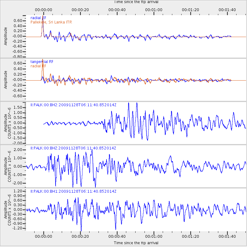
Signal To Noise
| Channel | StoN | STA | LTA |
| II:PALK:00:BHZ:20091128T06:11:40.852014Z | 4.1757507 | 5.822685E-7 | 1.3944043E-7 |
| II:PALK:00:BH1:20091128T06:11:40.852014Z | 2.2931697 | 1.6504578E-7 | 7.1972764E-8 |
| II:PALK:00:BH2:20091128T06:11:40.852014Z | 3.5197535 | 3.283206E-7 | 9.327943E-8 |
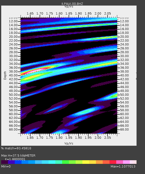
| Arrivals | |
| Ps | 4.2 SECOND |
| PpPs | 14 SECOND |
| PsPs/PpSs | 18 SECOND |

