You are here: Home > Network List > IU - Global Seismograph Network (GSN - IRIS/USGS) Stations List
> Station RSSD Black Hills, South Dakota, USA > Earthquake Result Viewer
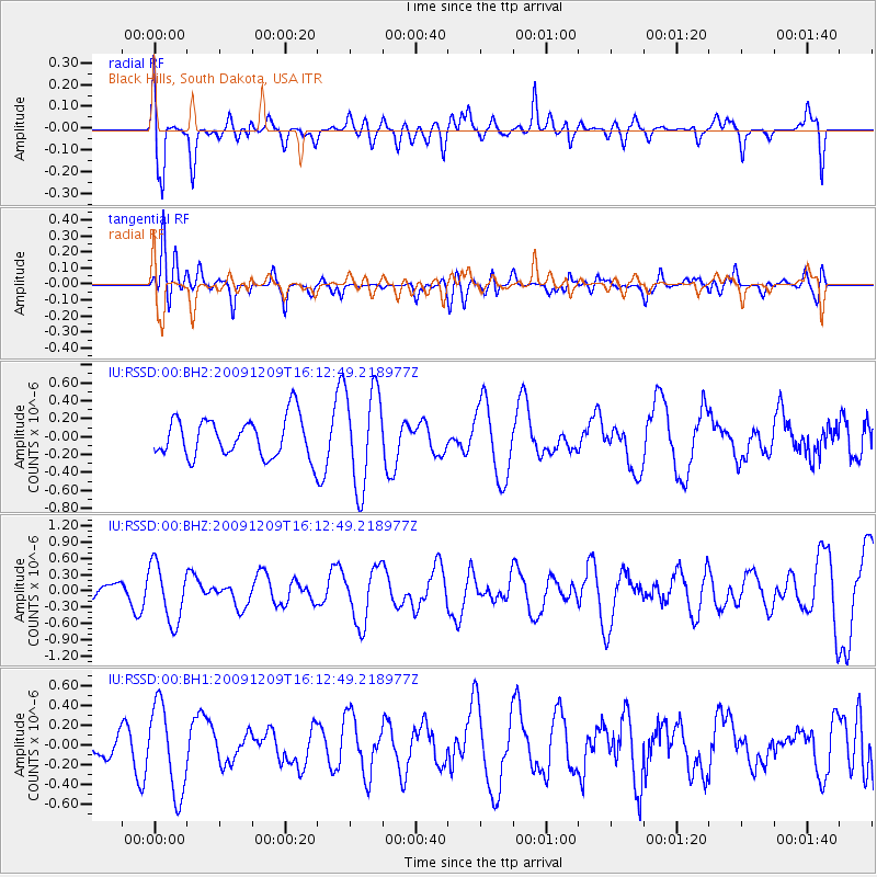
RSSD Black Hills, South Dakota, USA - Earthquake Result Viewer
*The percent match for this event was below the threshold and hence no stack was calculated.
| Earthquake location: |
Central Mid-Atlantic Ridge |
| Earthquake latitude/longitude: |
-0.6/-21.1 |
| Earthquake time(UTC): |
2009/12/09 (343) 16:00:43 GMT |
| Earthquake Depth: |
10 km |
| Earthquake Magnitude: |
5.5 MB, 5.6 MS, 6.4 MW, 6.4 MW |
| Earthquake Catalog/Contributor: |
WHDF/NEIC |
|
| Network: |
IU Global Seismograph Network (GSN - IRIS/USGS) |
| Station: |
RSSD Black Hills, South Dakota, USA |
| Lat/Lon: |
44.12 N/104.04 W |
| Elevation: |
2090 m |
|
| Distance: |
85.4 deg |
| Az: |
314.184 deg |
| Baz: |
95.353 deg |
| Ray Param: |
$rayparam |
*The percent match for this event was below the threshold and hence was not used in the summary stack. |
|
| Radial Match: |
57.374733 % |
| Radial Bump: |
400 |
| Transverse Match: |
46.42107 % |
| Transverse Bump: |
400 |
| SOD ConfigId: |
617450 |
| Insert Time: |
2013-09-30 20:13:04.334 +0000 |
| GWidth: |
2.5 |
| Max Bumps: |
400 |
| Tol: |
0.001 |
|
Signal To Noise
| Channel | StoN | STA | LTA |
| IU:RSSD:00:BHZ:20091209T16:12:49.218977Z | 1.618914 | 5.2877175E-7 | 3.2662126E-7 |
| IU:RSSD:00:BH1:20091209T16:12:49.218977Z | 2.0439467 | 4.464201E-7 | 2.1841082E-7 |
| IU:RSSD:00:BH2:20091209T16:12:49.218977Z | 2.501763 | 5.4836556E-7 | 2.1919163E-7 |
| Arrivals |
| Ps | |
| PpPs | |
| PsPs/PpSs | |


