You are here: Home > Network List > II - Global Seismograph Network (GSN - IRIS/IDA) Stations List
> Station KURK Kurchatov, Kazakhstan > Earthquake Result Viewer
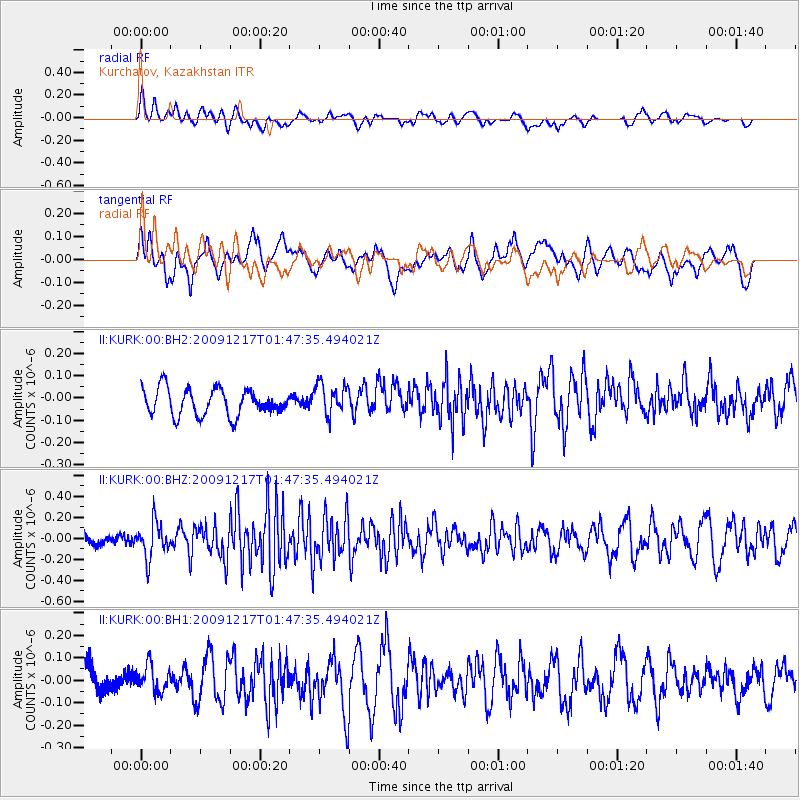
KURK Kurchatov, Kazakhstan - Earthquake Result Viewer
*The percent match for this event was below the threshold and hence no stack was calculated.
| Earthquake location: |
West Of Gibraltar |
| Earthquake latitude/longitude: |
36.5/-9.9 |
| Earthquake time(UTC): |
2009/12/17 (351) 01:37:48 GMT |
| Earthquake Depth: |
20 km |
| Earthquake Magnitude: |
5.6 MW, 5.5 MW, 5.7 MB |
| Earthquake Catalog/Contributor: |
NEIC PDE/NEIC PDE-M |
|
| Network: |
II Global Seismograph Network (GSN - IRIS/IDA) |
| Station: |
KURK Kurchatov, Kazakhstan |
| Lat/Lon: |
50.72 N/78.62 E |
| Elevation: |
184 m |
|
| Distance: |
62.0 deg |
| Az: |
46.053 deg |
| Baz: |
294.077 deg |
| Ray Param: |
$rayparam |
*The percent match for this event was below the threshold and hence was not used in the summary stack. |
|
| Radial Match: |
49.681034 % |
| Radial Bump: |
400 |
| Transverse Match: |
64.09416 % |
| Transverse Bump: |
400 |
| SOD ConfigId: |
617450 |
| Insert Time: |
2013-09-30 20:30:25.580 +0000 |
| GWidth: |
2.5 |
| Max Bumps: |
400 |
| Tol: |
0.001 |
|
Signal To Noise
| Channel | StoN | STA | LTA |
| II:KURK:00:BHZ:20091217T01:47:35.494021Z | 3.6926696 | 1.7004439E-7 | 4.6049173E-8 |
| II:KURK:00:BH1:20091217T01:47:35.494021Z | 0.88842756 | 5.8085035E-8 | 6.5379595E-8 |
| II:KURK:00:BH2:20091217T01:47:35.494021Z | 1.196804 | 7.098529E-8 | 5.931237E-8 |
| Arrivals |
| Ps | |
| PpPs | |
| PsPs/PpSs | |


