AAK Ala Archa, Kyrgyzstan - Earthquake Result Viewer
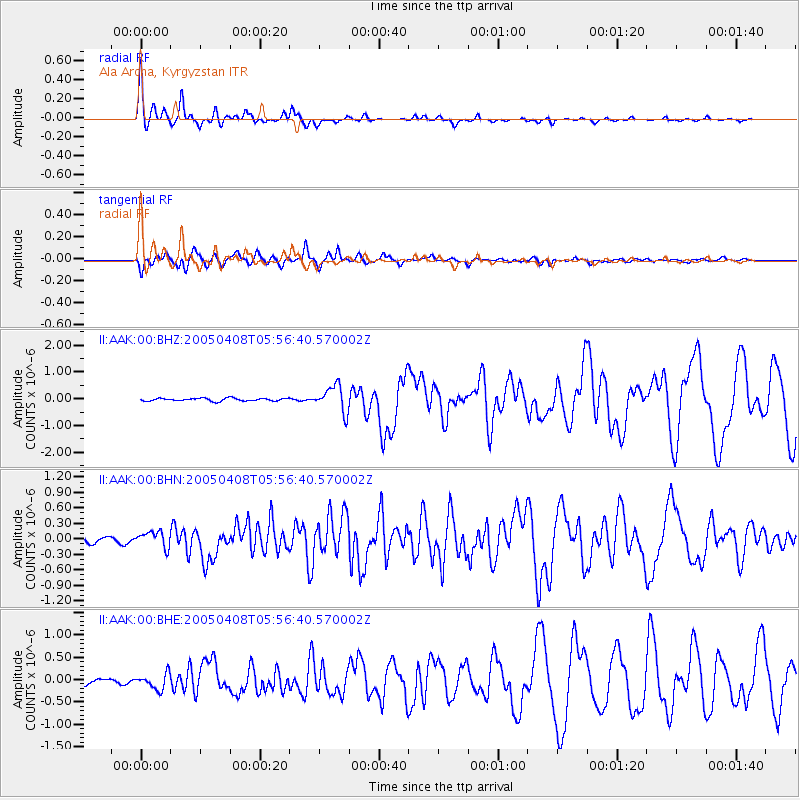
Earthquake location: Southwest Of Sumatra, Indonesia
Earthquake latitude/longitude: -0.2/97.7
Earthquake time(UTC): 2005/04/08 (098) 05:48:37 GMT
Earthquake Depth: 21 km
Earthquake Magnitude: 5.7 MB, 6.3 MS, 6.1 MW, 6.1 MW
Earthquake Catalog/Contributor: WHDF/NEIC
Network: II Global Seismograph Network (GSN - IRIS/IDA)
Station: AAK Ala Archa, Kyrgyzstan
Lat/Lon: 42.64 N/74.49 E
Elevation: 1645 m
Distance: 47.5 deg
Az: 336.744 deg
Baz: 147.651 deg
Ray Param: 0.06991625
Estimated Moho Depth: 60.5 km
Estimated Crust Vp/Vs: 1.68
Assumed Crust Vp: 6.306 km/s
Estimated Crust Vs: 3.765 km/s
Estimated Crust Poisson's Ratio: 0.22
Radial Match: 97.00593 %
Radial Bump: 283
Transverse Match: 93.42738 %
Transverse Bump: 400
SOD ConfigId: 2459
Insert Time: 2010-03-01 15:28:48.706 +0000
GWidth: 2.5
Max Bumps: 400
Tol: 0.001

Signal To Noise

ChannelStoNSTALTA
II:AAK:00:BHN:20050408T05:56:40.570002Z2.15092781.5440726E-77.178635E-8
II:AAK:00:BHE:20050408T05:56:40.570002Z2.20517851.7858477E-78.098427E-8
II:AAK:00:BHZ:20050408T05:56:40.570002Z9.2257654.8668045E-75.275231E-8
Arrivals
Ps6.9 SECOND
PpPs24 SECOND
PsPs/PpSs31 SECOND