You are here: Home > Network List > IU - Global Seismograph Network (GSN - IRIS/USGS) Stations List
> Station RSSD Black Hills, South Dakota, USA > Earthquake Result Viewer
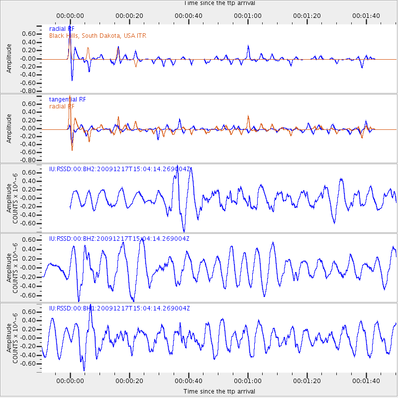
RSSD Black Hills, South Dakota, USA - Earthquake Result Viewer
*The percent match for this event was below the threshold and hence no stack was calculated.
| Earthquake location: |
Azores Islands Region |
| Earthquake latitude/longitude: |
42.4/-30.6 |
| Earthquake time(UTC): |
2009/12/17 (351) 14:55:36 GMT |
| Earthquake Depth: |
4.0 km |
| Earthquake Magnitude: |
5.5 MW |
| Earthquake Catalog/Contributor: |
NEIC PDE/NEIC PDE-M |
|
| Network: |
IU Global Seismograph Network (GSN - IRIS/USGS) |
| Station: |
RSSD Black Hills, South Dakota, USA |
| Lat/Lon: |
44.12 N/104.04 W |
| Elevation: |
2090 m |
|
| Distance: |
51.8 deg |
| Az: |
298.553 deg |
| Baz: |
64.516 deg |
| Ray Param: |
$rayparam |
*The percent match for this event was below the threshold and hence was not used in the summary stack. |
|
| Radial Match: |
56.27481 % |
| Radial Bump: |
400 |
| Transverse Match: |
44.47759 % |
| Transverse Bump: |
302 |
| SOD ConfigId: |
617450 |
| Insert Time: |
2013-09-30 20:32:09.676 +0000 |
| GWidth: |
2.5 |
| Max Bumps: |
400 |
| Tol: |
0.001 |
|
Signal To Noise
| Channel | StoN | STA | LTA |
| IU:RSSD:00:BHZ:20091217T15:04:14.269004Z | 3.4753492 | 3.691891E-7 | 1.0623079E-7 |
| IU:RSSD:00:BH1:20091217T15:04:14.269004Z | 1.9589128 | 3.4686184E-7 | 1.7706854E-7 |
| IU:RSSD:00:BH2:20091217T15:04:14.269004Z | 1.3948559 | 2.0536923E-7 | 1.4723331E-7 |
| Arrivals |
| Ps | |
| PpPs | |
| PsPs/PpSs | |


