You are here: Home > Network List > IU - Global Seismograph Network (GSN - IRIS/USGS) Stations List
> Station RSSD Black Hills, South Dakota, USA > Earthquake Result Viewer
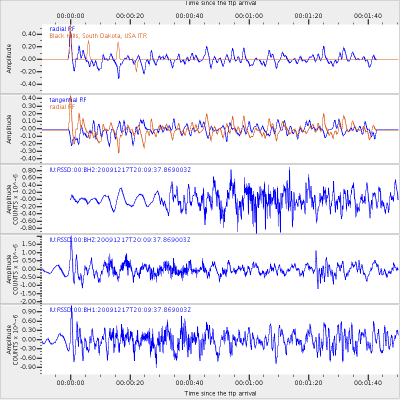
RSSD Black Hills, South Dakota, USA - Earthquake Result Viewer
*The percent match for this event was below the threshold and hence no stack was calculated.
| Earthquake location: |
Rat Islands, Aleutian Islands |
| Earthquake latitude/longitude: |
51.4/180.0 |
| Earthquake time(UTC): |
2009/12/17 (351) 20:01:21 GMT |
| Earthquake Depth: |
35 km |
| Earthquake Magnitude: |
5.8 MW, 5.7 MW, 6.2 MB |
| Earthquake Catalog/Contributor: |
NEIC PDE/NEIC PDE-M |
|
| Network: |
IU Global Seismograph Network (GSN - IRIS/USGS) |
| Station: |
RSSD Black Hills, South Dakota, USA |
| Lat/Lon: |
44.12 N/104.04 W |
| Elevation: |
2090 m |
|
| Distance: |
49.5 deg |
| Az: |
66.848 deg |
| Baz: |
306.89 deg |
| Ray Param: |
$rayparam |
*The percent match for this event was below the threshold and hence was not used in the summary stack. |
|
| Radial Match: |
69.098526 % |
| Radial Bump: |
400 |
| Transverse Match: |
55.170998 % |
| Transverse Bump: |
400 |
| SOD ConfigId: |
617450 |
| Insert Time: |
2013-09-30 20:33:24.511 +0000 |
| GWidth: |
2.5 |
| Max Bumps: |
400 |
| Tol: |
0.001 |
|
Signal To Noise
| Channel | StoN | STA | LTA |
| IU:RSSD:00:BHZ:20091217T20:09:37.869003Z | 3.8199441 | 7.5513714E-7 | 1.9768277E-7 |
| IU:RSSD:00:BH1:20091217T20:09:37.869003Z | 2.537748 | 4.3553433E-7 | 1.7162237E-7 |
| IU:RSSD:00:BH2:20091217T20:09:37.869003Z | 1.8132265 | 2.2709706E-7 | 1.2524472E-7 |
| Arrivals |
| Ps | |
| PpPs | |
| PsPs/PpSs | |


