AAK Ala Archa, Kyrgyzstan - Earthquake Result Viewer
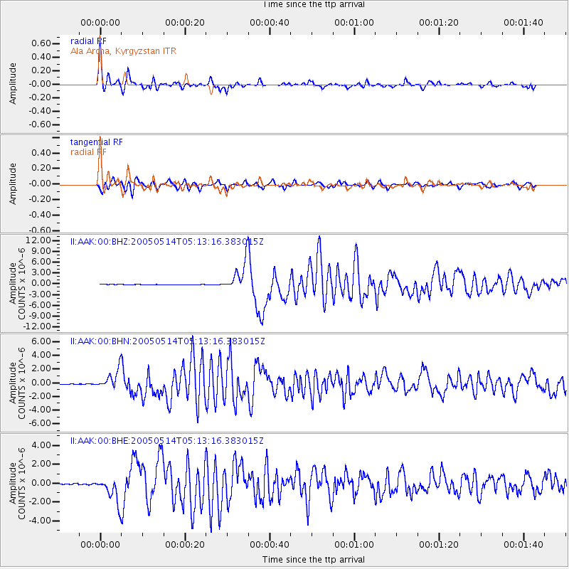
Earthquake location: Northern Sumatra, Indonesia
Earthquake latitude/longitude: 0.6/98.5
Earthquake time(UTC): 2005/05/14 (134) 05:05:18 GMT
Earthquake Depth: 34 km
Earthquake Magnitude: 6.4 MB, 6.8 MS, 6.8 MW, 6.8 MW
Earthquake Catalog/Contributor: WHDF/NEIC
Network: II Global Seismograph Network (GSN - IRIS/IDA)
Station: AAK Ala Archa, Kyrgyzstan
Lat/Lon: 42.64 N/74.49 E
Elevation: 1645 m
Distance: 47.1 deg
Az: 335.836 deg
Baz: 146.308 deg
Ray Param: 0.07016557
Estimated Moho Depth: 53.5 km
Estimated Crust Vp/Vs: 1.74
Assumed Crust Vp: 6.306 km/s
Estimated Crust Vs: 3.629 km/s
Estimated Crust Poisson's Ratio: 0.25
Radial Match: 94.26282 %
Radial Bump: 400
Transverse Match: 85.74097 %
Transverse Bump: 400
SOD ConfigId: 2455
Insert Time: 2010-03-01 15:28:55.018 +0000
GWidth: 2.5
Max Bumps: 400
Tol: 0.001

Signal To Noise

ChannelStoNSTALTA
II:AAK:00:BHN:20050514T05:13:16.383015Z37.3551031.5014647E-64.0194365E-8
II:AAK:00:BHE:20050514T05:13:16.383015Z29.9520841.4332686E-64.785205E-8
II:AAK:00:BHZ:20050514T05:13:16.383015Z74.780684.3245846E-65.7830242E-8
Arrivals
Ps6.6 SECOND
PpPs22 SECOND
PsPs/PpSs29 SECOND