You are here: Home > Network List > IU - Global Seismograph Network (GSN - IRIS/USGS) Stations List
> Station RSSD Black Hills, South Dakota, USA > Earthquake Result Viewer
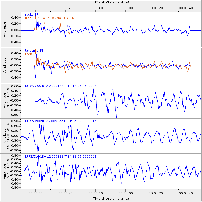
RSSD Black Hills, South Dakota, USA - Earthquake Result Viewer
*The percent match for this event was below the threshold and hence no stack was calculated.
| Earthquake location: |
Southern Peru |
| Earthquake latitude/longitude: |
-15.8/-74.0 |
| Earthquake time(UTC): |
2009/12/24 (358) 14:01:58 GMT |
| Earthquake Depth: |
59 km |
| Earthquake Magnitude: |
5.6 MW, 5.5 MW, 5.7 MB |
| Earthquake Catalog/Contributor: |
NEIC PDE/NEIC PDE-M |
|
| Network: |
IU Global Seismograph Network (GSN - IRIS/USGS) |
| Station: |
RSSD Black Hills, South Dakota, USA |
| Lat/Lon: |
44.12 N/104.04 W |
| Elevation: |
2090 m |
|
| Distance: |
65.6 deg |
| Az: |
336.668 deg |
| Baz: |
148.028 deg |
| Ray Param: |
$rayparam |
*The percent match for this event was below the threshold and hence was not used in the summary stack. |
|
| Radial Match: |
60.982117 % |
| Radial Bump: |
400 |
| Transverse Match: |
84.219765 % |
| Transverse Bump: |
400 |
| SOD ConfigId: |
617450 |
| Insert Time: |
2013-09-30 20:51:44.525 +0000 |
| GWidth: |
2.5 |
| Max Bumps: |
400 |
| Tol: |
0.001 |
|
Signal To Noise
| Channel | StoN | STA | LTA |
| IU:RSSD:00:BHZ:20091224T14:12:05.969001Z | 4.438587 | 6.1137735E-7 | 1.3774142E-7 |
| IU:RSSD:00:BH1:20091224T14:12:05.969001Z | 2.1668715 | 3.474754E-7 | 1.6035808E-7 |
| IU:RSSD:00:BH2:20091224T14:12:05.969001Z | 1.3623626 | 1.615405E-7 | 1.1857378E-7 |
| Arrivals |
| Ps | |
| PpPs | |
| PsPs/PpSs | |


