You are here: Home > Network List > II - Global Seismograph Network (GSN - IRIS/IDA) Stations List
> Station MSEY Mahe, Seychelles > Earthquake Result Viewer
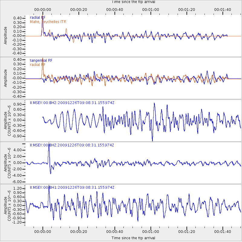
MSEY Mahe, Seychelles - Earthquake Result Viewer
*The percent match for this event was below the threshold and hence no stack was calculated.
| Earthquake location: |
Banda Sea |
| Earthquake latitude/longitude: |
-5.5/131.2 |
| Earthquake time(UTC): |
2009/12/26 (360) 08:57:27 GMT |
| Earthquake Depth: |
85 km |
| Earthquake Magnitude: |
6.1 MW, 6.1 MB, 6.1 MW |
| Earthquake Catalog/Contributor: |
NEIC PDE/NEIC PDE-M |
|
| Network: |
II Global Seismograph Network (GSN - IRIS/IDA) |
| Station: |
MSEY Mahe, Seychelles |
| Lat/Lon: |
4.67 S/55.48 E |
| Elevation: |
475 m |
|
| Distance: |
75.4 deg |
| Az: |
266.62 deg |
| Baz: |
94.478 deg |
| Ray Param: |
$rayparam |
*The percent match for this event was below the threshold and hence was not used in the summary stack. |
|
| Radial Match: |
68.78379 % |
| Radial Bump: |
400 |
| Transverse Match: |
69.18764 % |
| Transverse Bump: |
400 |
| SOD ConfigId: |
617450 |
| Insert Time: |
2013-09-30 20:56:51.776 +0000 |
| GWidth: |
2.5 |
| Max Bumps: |
400 |
| Tol: |
0.001 |
|
Signal To Noise
| Channel | StoN | STA | LTA |
| II:MSEY:00:BHZ:20091226T09:08:31.155974Z | 9.505724 | 2.0017553E-6 | 2.1058419E-7 |
| II:MSEY:00:BH1:20091226T09:08:31.155974Z | 1.534019 | 4.3453383E-7 | 2.8326497E-7 |
| II:MSEY:00:BH2:20091226T09:08:31.155974Z | 1.0924429 | 3.4363677E-7 | 3.1455812E-7 |
| Arrivals |
| Ps | |
| PpPs | |
| PsPs/PpSs | |


