
AAK Ala Archa, Kyrgyzstan - Earthquake Result Viewer
| ||||||||||||||||||
| ||||||||||||||||||
| ||||||||||||||||||
|
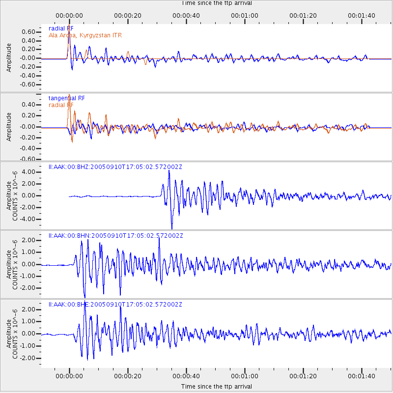
Signal To Noise
| Channel | StoN | STA | LTA |
| II:AAK:00:BHN:20050910T17:05:02.572002Z | 29.591377 | 7.62557E-7 | 2.5769566E-8 |
| II:AAK:00:BHE:20050910T17:05:02.572002Z | 18.413174 | 6.048632E-7 | 3.284948E-8 |
| II:AAK:00:BHZ:20050910T17:05:02.572002Z | 27.89593 | 1.4681798E-6 | 5.263061E-8 |
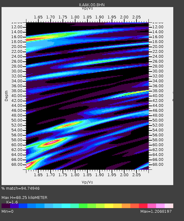
| Arrivals | |
| Ps | 7.0 SECOND |
| PpPs | 26 SECOND |
| PsPs/PpSs | 33 SECOND |

