You are here: Home > Network List > GS - US Geological Survey Networks Stations List
> Station KAN08 Anthony NE Station > Earthquake Result Viewer
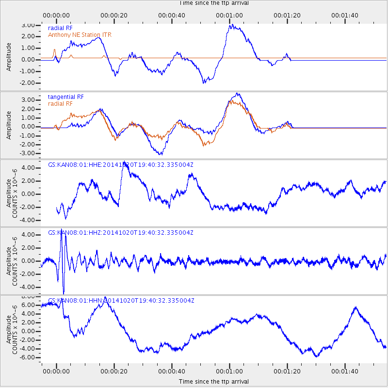
KAN08 Anthony NE Station - Earthquake Result Viewer
*The percent match for this event was below the threshold and hence no stack was calculated.
| Earthquake location: |
Colombia-Ecuador Border Region |
| Earthquake latitude/longitude: |
0.6/-77.8 |
| Earthquake time(UTC): |
2014/10/20 (293) 19:33:21 GMT |
| Earthquake Depth: |
10 km |
| Earthquake Magnitude: |
6.0 MB, 5.6 MWB |
| Earthquake Catalog/Contributor: |
NEIC PDE/NEIC COMCAT |
|
| Network: |
GS US Geological Survey Networks |
| Station: |
KAN08 Anthony NE Station |
| Lat/Lon: |
37.23 N/97.97 W |
| Elevation: |
375 m |
|
| Distance: |
40.9 deg |
| Az: |
335.213 deg |
| Baz: |
148.318 deg |
| Ray Param: |
$rayparam |
*The percent match for this event was below the threshold and hence was not used in the summary stack. |
|
| Radial Match: |
19.524439 % |
| Radial Bump: |
400 |
| Transverse Match: |
28.761036 % |
| Transverse Bump: |
400 |
| SOD ConfigId: |
3390531 |
| Insert Time: |
2019-04-14 15:40:27.313 +0000 |
| GWidth: |
2.5 |
| Max Bumps: |
400 |
| Tol: |
0.001 |
|
Signal To Noise
| Channel | StoN | STA | LTA |
| GS:KAN08:01:HHZ:20141020T19:40:32.335004Z | 7.719026 | 2.3329098E-6 | 3.022285E-7 |
| GS:KAN08:01:HHN:20141020T19:40:32.335004Z | 2.0708492 | 1.2281617E-5 | 5.9307154E-6 |
| GS:KAN08:01:HHE:20141020T19:40:32.335004Z | 0.4592066 | 9.2941684E-7 | 2.0239622E-6 |
| Arrivals |
| Ps | |
| PpPs | |
| PsPs/PpSs | |


