AAK Ala Archa, Kyrgyzstan - Earthquake Result Viewer
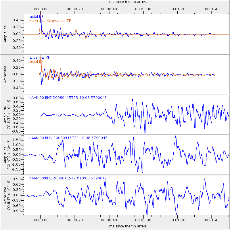
Earthquake location: Andreanof Islands, Aleutian Is.
Earthquake latitude/longitude: 51.9/-179.4
Earthquake time(UTC): 2008/04/15 (106) 22:59:51 GMT
Earthquake Depth: 10 km
Earthquake Magnitude: 6.1 MB, 6.4 MS, 6.4 MW, 6.4 MW
Earthquake Catalog/Contributor: WHDF/NEIC
Network: II Global Seismograph Network (GSN - IRIS/IDA)
Station: AAK Ala Archa, Kyrgyzstan
Lat/Lon: 42.64 N/74.49 E
Elevation: 1645 m
Distance: 66.3 deg
Az: 309.273 deg
Baz: 40.594 deg
Ray Param: 0.057713985
Estimated Moho Depth: 52.0 km
Estimated Crust Vp/Vs: 1.66
Assumed Crust Vp: 6.306 km/s
Estimated Crust Vs: 3.805 km/s
Estimated Crust Poisson's Ratio: 0.21
Radial Match: 93.840645 %
Radial Bump: 400
Transverse Match: 92.64926 %
Transverse Bump: 400
SOD ConfigId: 2504
Insert Time: 2010-03-01 15:29:44.021 +0000
GWidth: 2.5
Max Bumps: 400
Tol: 0.001

Signal To Noise

ChannelStoNSTALTA
II:AAK:00:BHN:20080415T23:10:08.579004Z4.77657182.8628023E-75.993425E-8
II:AAK:00:BHE:20080415T23:10:08.579004Z3.35434771.2774302E-73.808282E-8
II:AAK:00:BHZ:20080415T23:10:08.579004Z1.56753595.4439912E-83.4729613E-8
Arrivals
Ps5.7 SECOND
PpPs21 SECOND
PsPs/PpSs27 SECOND