You are here: Home > Network List > IU - Global Seismograph Network (GSN - IRIS/USGS) Stations List
> Station HKT Hockley, Texas > Earthquake Result Viewer
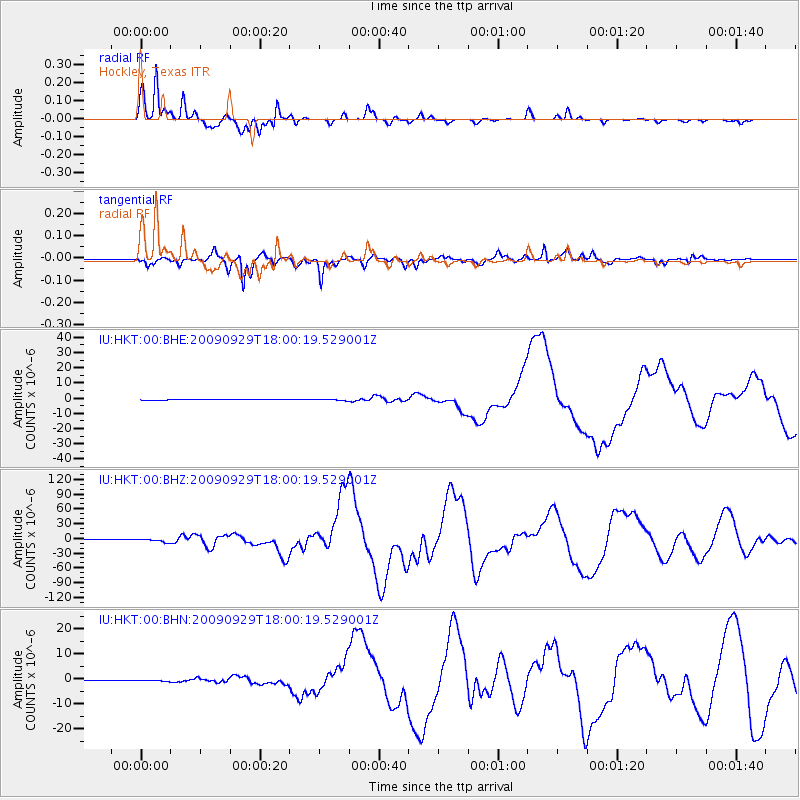
HKT Hockley, Texas - Earthquake Result Viewer
*The percent match for this event was below the threshold and hence no stack was calculated.
| Earthquake location: |
Samoa Islands Region |
| Earthquake latitude/longitude: |
-15.5/-172.1 |
| Earthquake time(UTC): |
2009/09/29 (272) 17:48:10 GMT |
| Earthquake Depth: |
18 km |
| Earthquake Magnitude: |
7.1 MB, 8.1 MS, 8.1 MW, 8.0 MW |
| Earthquake Catalog/Contributor: |
WHDF/NEIC |
|
| Network: |
IU Global Seismograph Network (GSN - IRIS/USGS) |
| Station: |
HKT Hockley, Texas |
| Lat/Lon: |
29.96 N/95.84 W |
| Elevation: |
-413.0 m |
|
| Distance: |
86.2 deg |
| Az: |
57.656 deg |
| Baz: |
249.824 deg |
| Ray Param: |
$rayparam |
*The percent match for this event was below the threshold and hence was not used in the summary stack. |
|
| Radial Match: |
96.51188 % |
| Radial Bump: |
282 |
| Transverse Match: |
94.58791 % |
| Transverse Bump: |
370 |
| SOD ConfigId: |
1 |
| Insert Time: |
2010-02-19 00:20:46.057 +0000 |
| GWidth: |
2.5 |
| Max Bumps: |
400 |
| Tol: |
0.001 |
|
Signal To Noise
| Channel | StoN | STA | LTA |
| IU:HKT:00:BHZ:20090929T18:00:19.529001Z | 16.083632 | 3.0958647E-6 | 1.9248543E-7 |
| IU:HKT:00:BHN:20090929T18:00:19.529001Z | 1.254985 | 1.9945504E-7 | 1.5893022E-7 |
| IU:HKT:00:BHE:20090929T18:00:19.529001Z | 2.5799608 | 5.15538E-7 | 1.9982396E-7 |
| Arrivals |
| Ps | |
| PpPs | |
| PsPs/PpSs | |


