You are here: Home > Network List > II - Global Seismograph Network (GSN - IRIS/IDA) Stations List
> Station KURK Kurchatov, Kazakhstan > Earthquake Result Viewer
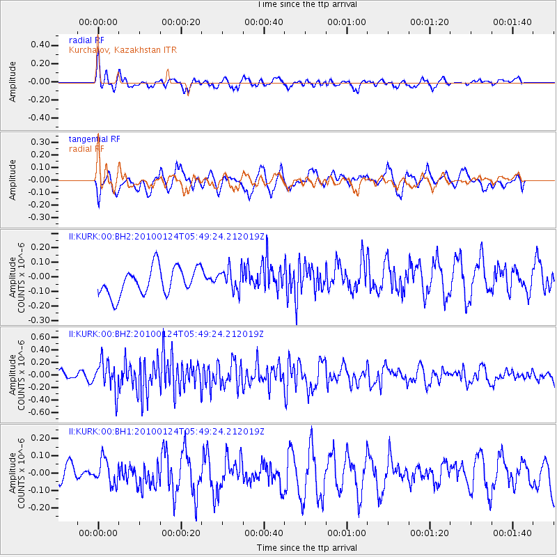
KURK Kurchatov, Kazakhstan - Earthquake Result Viewer
*The percent match for this event was below the threshold and hence no stack was calculated.
| Earthquake location: |
Timor Sea |
| Earthquake latitude/longitude: |
-8.2/129.0 |
| Earthquake time(UTC): |
2010/01/24 (024) 05:38:26 GMT |
| Earthquake Depth: |
19 km |
| Earthquake Magnitude: |
5.5 MW |
| Earthquake Catalog/Contributor: |
NEIC PDE/NEIC PDE-M |
|
| Network: |
II Global Seismograph Network (GSN - IRIS/IDA) |
| Station: |
KURK Kurchatov, Kazakhstan |
| Lat/Lon: |
50.72 N/78.62 E |
| Elevation: |
184 m |
|
| Distance: |
73.0 deg |
| Az: |
329.193 deg |
| Baz: |
127.109 deg |
| Ray Param: |
$rayparam |
*The percent match for this event was below the threshold and hence was not used in the summary stack. |
|
| Radial Match: |
57.34934 % |
| Radial Bump: |
396 |
| Transverse Match: |
53.597054 % |
| Transverse Bump: |
400 |
| SOD ConfigId: |
617450 |
| Insert Time: |
2013-09-30 22:31:47.384 +0000 |
| GWidth: |
2.5 |
| Max Bumps: |
400 |
| Tol: |
0.001 |
|
Signal To Noise
| Channel | StoN | STA | LTA |
| II:KURK:00:BHZ:20100124T05:49:24.212019Z | 1.9057566 | 2.445238E-7 | 1.2830797E-7 |
| II:KURK:00:BH1:20100124T05:49:24.212019Z | 1.0708358 | 8.329163E-8 | 7.7781884E-8 |
| II:KURK:00:BH2:20100124T05:49:24.212019Z | 0.84184784 | 7.864965E-8 | 9.3425015E-8 |
| Arrivals |
| Ps | |
| PpPs | |
| PsPs/PpSs | |


