You are here: Home > Network List > IU - Global Seismograph Network (GSN - IRIS/USGS) Stations List
> Station RSSD Black Hills, South Dakota, USA > Earthquake Result Viewer
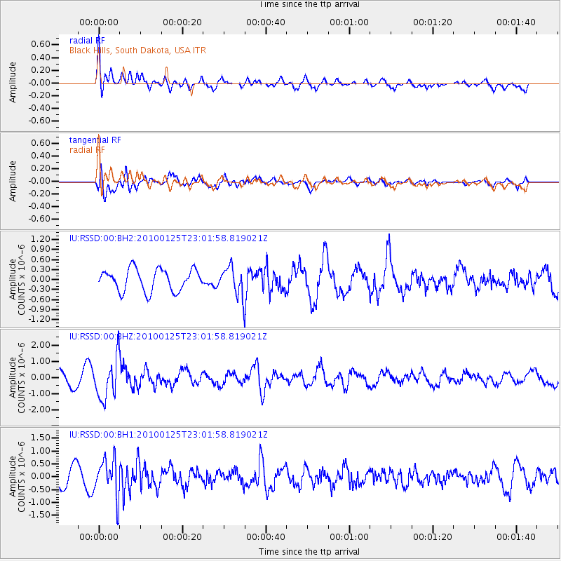
RSSD Black Hills, South Dakota, USA - Earthquake Result Viewer
*The percent match for this event was below the threshold and hence no stack was calculated.
| Earthquake location: |
Peru-Brazil Border Region |
| Earthquake latitude/longitude: |
-8.5/-74.5 |
| Earthquake time(UTC): |
2010/01/25 (025) 22:52:46 GMT |
| Earthquake Depth: |
147 km |
| Earthquake Magnitude: |
5.7 MB, 5.9 MW, 5.9 MW |
| Earthquake Catalog/Contributor: |
WHDF/NEIC |
|
| Network: |
IU Global Seismograph Network (GSN - IRIS/USGS) |
| Station: |
RSSD Black Hills, South Dakota, USA |
| Lat/Lon: |
44.12 N/104.04 W |
| Elevation: |
2090 m |
|
| Distance: |
58.8 deg |
| Az: |
335.454 deg |
| Baz: |
145.21 deg |
| Ray Param: |
$rayparam |
*The percent match for this event was below the threshold and hence was not used in the summary stack. |
|
| Radial Match: |
78.22362 % |
| Radial Bump: |
400 |
| Transverse Match: |
69.77362 % |
| Transverse Bump: |
400 |
| SOD ConfigId: |
617450 |
| Insert Time: |
2013-09-30 22:39:37.346 +0000 |
| GWidth: |
2.5 |
| Max Bumps: |
400 |
| Tol: |
0.001 |
|
Signal To Noise
| Channel | StoN | STA | LTA |
| IU:RSSD:00:BHZ:20100125T23:01:58.819021Z | 3.2230039 | 1.3136336E-6 | 4.075805E-7 |
| IU:RSSD:00:BH1:20100125T23:01:58.819021Z | 2.2031162 | 7.7011606E-7 | 3.4955764E-7 |
| IU:RSSD:00:BH2:20100125T23:01:58.819021Z | 1.336868 | 4.3385103E-7 | 3.2452795E-7 |
| Arrivals |
| Ps | |
| PpPs | |
| PsPs/PpSs | |


