You are here: Home > Network List > II - Global Seismograph Network (GSN - IRIS/IDA) Stations List
> Station KAPI Kappang, Sulawesi, Indonesia > Earthquake Result Viewer
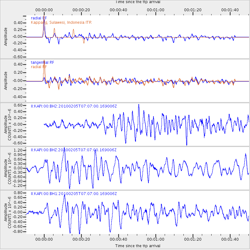
KAPI Kappang, Sulawesi, Indonesia - Earthquake Result Viewer
*The percent match for this event was below the threshold and hence no stack was calculated.
| Earthquake location: |
Southeast Indian Ridge |
| Earthquake latitude/longitude: |
-47.9/99.6 |
| Earthquake time(UTC): |
2010/02/05 (036) 06:59:05 GMT |
| Earthquake Depth: |
1.0 km |
| Earthquake Magnitude: |
6.2 MW, 5.7 MB, 6.2 MS, 6.2 MW |
| Earthquake Catalog/Contributor: |
NEIC PDE/NEIC PDE-M |
|
| Network: |
II Global Seismograph Network (GSN - IRIS/IDA) |
| Station: |
KAPI Kappang, Sulawesi, Indonesia |
| Lat/Lon: |
5.01 S/119.75 E |
| Elevation: |
300 m |
|
| Distance: |
46.1 deg |
| Az: |
28.455 deg |
| Baz: |
198.77 deg |
| Ray Param: |
$rayparam |
*The percent match for this event was below the threshold and hence was not used in the summary stack. |
|
| Radial Match: |
71.68215 % |
| Radial Bump: |
400 |
| Transverse Match: |
66.35284 % |
| Transverse Bump: |
400 |
| SOD ConfigId: |
617450 |
| Insert Time: |
2013-09-30 22:59:36.640 +0000 |
| GWidth: |
2.5 |
| Max Bumps: |
400 |
| Tol: |
0.001 |
|
Signal To Noise
| Channel | StoN | STA | LTA |
| II:KAPI:00:BHZ:20100205T07:07:00.169006Z | 5.983386 | 4.7183184E-7 | 7.885699E-8 |
| II:KAPI:00:BH1:20100205T07:07:00.169006Z | 3.7004642 | 2.234493E-7 | 6.038413E-8 |
| II:KAPI:00:BH2:20100205T07:07:00.169006Z | 2.0836291 | 1.3048582E-7 | 6.2624295E-8 |
| Arrivals |
| Ps | |
| PpPs | |
| PsPs/PpSs | |


