
HOPE Hope Point, South Georgia Island - Earthquake Result Viewer
| ||||||||||||||||||
| ||||||||||||||||||
| ||||||||||||||||||
|
Signal To Noise
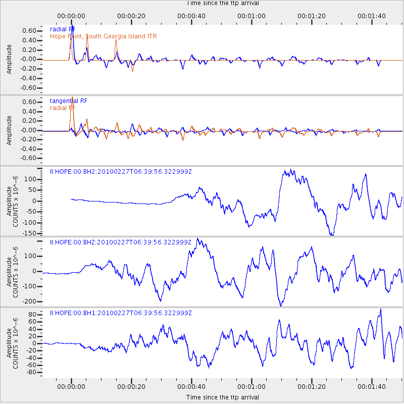
| Channel | StoN | STA | LTA |
| II:HOPE:00:BHZ:20100227T06:39:56.322999Z | 2.603287 | 1.5988986E-5 | 6.141845E-6 |
| II:HOPE:00:BH1:20100227T06:39:56.322999Z | 1.3237664 | 4.3692125E-6 | 3.300592E-6 |
| II:HOPE:00:BH2:20100227T06:39:56.322999Z | 1.385665 | 8.607307E-6 | 6.2116796E-6 |
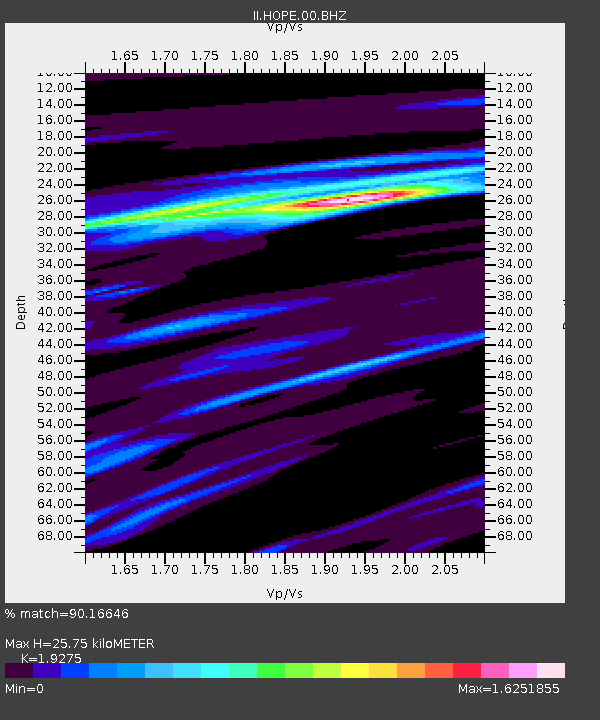
| Arrivals | |
| Ps | 5.2 SECOND |
| PpPs | 15 SECOND |
| PsPs/PpSs | 21 SECOND |

