You are here: Home > Network List > IU - Global Seismograph Network (GSN - IRIS/USGS) Stations List
> Station RSSD Black Hills, South Dakota, USA > Earthquake Result Viewer
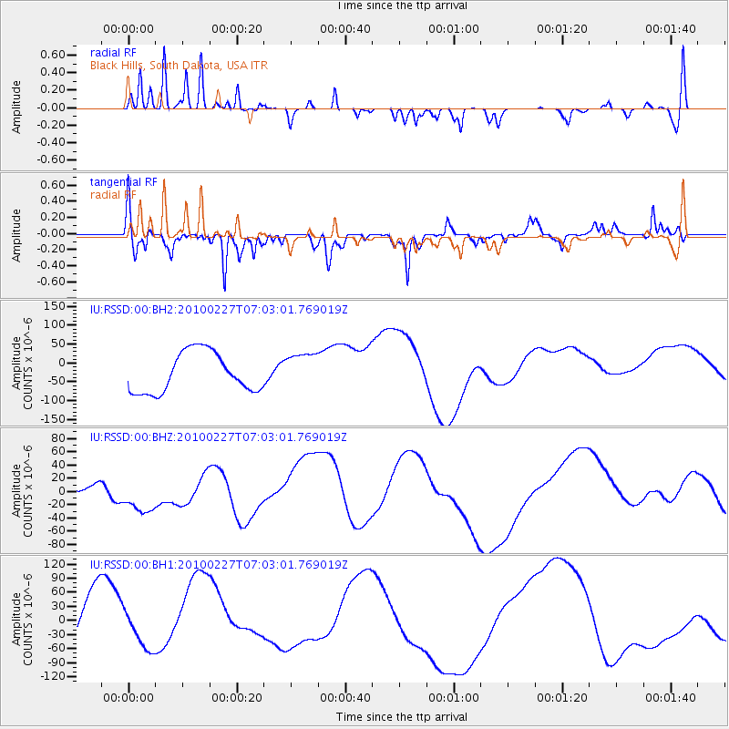
RSSD Black Hills, South Dakota, USA - Earthquake Result Viewer
*The percent match for this event was below the threshold and hence no stack was calculated.
| Earthquake location: |
San Juan Province, Argentina |
| Earthquake latitude/longitude: |
-31.7/-69.1 |
| Earthquake time(UTC): |
2010/02/27 (058) 06:51:17 GMT |
| Earthquake Depth: |
40 km |
| Earthquake Magnitude: |
6.0 MB |
| Earthquake Catalog/Contributor: |
NEIC PDE/NEIC PDE-M |
|
| Network: |
IU Global Seismograph Network (GSN - IRIS/USGS) |
| Station: |
RSSD Black Hills, South Dakota, USA |
| Lat/Lon: |
44.12 N/104.04 W |
| Elevation: |
2090 m |
|
| Distance: |
81.9 deg |
| Az: |
335.406 deg |
| Baz: |
150.478 deg |
| Ray Param: |
$rayparam |
*The percent match for this event was below the threshold and hence was not used in the summary stack. |
|
| Radial Match: |
34.373623 % |
| Radial Bump: |
195 |
| Transverse Match: |
41.469486 % |
| Transverse Bump: |
311 |
| SOD ConfigId: |
617450 |
| Insert Time: |
2013-10-01 00:00:25.896 +0000 |
| GWidth: |
2.5 |
| Max Bumps: |
400 |
| Tol: |
0.001 |
|
Signal To Noise
| Channel | StoN | STA | LTA |
| IU:RSSD:00:BHZ:20100227T07:03:01.769019Z | 1.2020549 | 2.8536117E-5 | 2.3739445E-5 |
| IU:RSSD:00:BH1:20100227T07:03:01.769019Z | 0.671794 | 3.493361E-5 | 5.200048E-5 |
| IU:RSSD:00:BH2:20100227T07:03:01.769019Z | 0.9354089 | 4.940232E-5 | 5.2813608E-5 |
| Arrivals |
| Ps | |
| PpPs | |
| PsPs/PpSs | |


