AAK Ala Archa, Kyrgyzstan - Earthquake Result Viewer
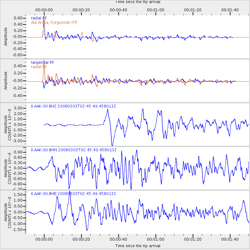
Earthquake location: Southern Sumatra, Indonesia
Earthquake latitude/longitude: -2.2/99.8
Earthquake time(UTC): 2008/03/03 (063) 02:37:27 GMT
Earthquake Depth: 25 km
Earthquake Magnitude: 5.8 MB, 6.1 MS, 6.1 MW, 6.1 MW
Earthquake Catalog/Contributor: WHDF/NEIC
Network: II Global Seismograph Network (GSN - IRIS/IDA)
Station: AAK Ala Archa, Kyrgyzstan
Lat/Lon: 42.64 N/74.49 E
Elevation: 1645 m
Distance: 50.1 deg
Az: 335.714 deg
Baz: 146.153 deg
Ray Param: 0.06821812
Estimated Moho Depth: 40.5 km
Estimated Crust Vp/Vs: 2.01
Assumed Crust Vp: 6.306 km/s
Estimated Crust Vs: 3.137 km/s
Estimated Crust Poisson's Ratio: 0.34
Radial Match: 93.55402 %
Radial Bump: 400
Transverse Match: 89.00074 %
Transverse Bump: 400
SOD ConfigId: 2564
Insert Time: 2010-03-01 15:31:32.232 +0000
GWidth: 2.5
Max Bumps: 400
Tol: 0.001

Signal To Noise

ChannelStoNSTALTA
II:AAK:00:BHN:20080303T02:45:49.458013Z4.7867493.3549597E-77.008848E-8
II:AAK:00:BHE:20080303T02:45:49.458013Z6.5892084.5457392E-76.898764E-8
II:AAK:00:BHZ:20080303T02:45:49.458013Z13.4357681.2427223E-69.249358E-8
Arrivals
Ps6.8 SECOND
PpPs18 SECOND
PsPs/PpSs25 SECOND