You are here: Home > Network List > IU - Global Seismograph Network (GSN - IRIS/USGS) Stations List
> Station RSSD Black Hills, South Dakota, USA > Earthquake Result Viewer
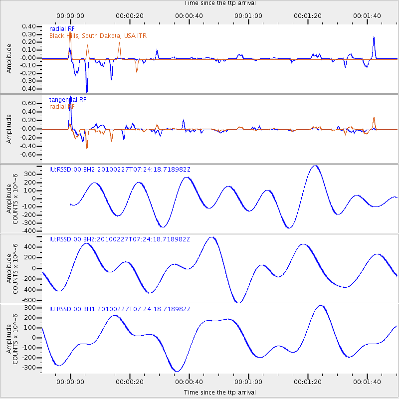
RSSD Black Hills, South Dakota, USA - Earthquake Result Viewer
*The percent match for this event was below the threshold and hence no stack was calculated.
| Earthquake location: |
Near Coast Of Central Chile |
| Earthquake latitude/longitude: |
-33.9/-71.9 |
| Earthquake time(UTC): |
2010/02/27 (058) 07:12:28 GMT |
| Earthquake Depth: |
35 km |
| Earthquake Magnitude: |
6.0 MB |
| Earthquake Catalog/Contributor: |
NEIC PDE/NEIC PDE-M |
|
| Network: |
IU Global Seismograph Network (GSN - IRIS/USGS) |
| Station: |
RSSD Black Hills, South Dakota, USA |
| Lat/Lon: |
44.12 N/104.04 W |
| Elevation: |
2090 m |
|
| Distance: |
83.0 deg |
| Az: |
337.322 deg |
| Baz: |
153.553 deg |
| Ray Param: |
$rayparam |
*The percent match for this event was below the threshold and hence was not used in the summary stack. |
|
| Radial Match: |
88.81705 % |
| Radial Bump: |
350 |
| Transverse Match: |
59.995495 % |
| Transverse Bump: |
323 |
| SOD ConfigId: |
617450 |
| Insert Time: |
2013-10-01 00:07:00.563 +0000 |
| GWidth: |
2.5 |
| Max Bumps: |
400 |
| Tol: |
0.001 |
|
Signal To Noise
| Channel | StoN | STA | LTA |
| IU:RSSD:00:BHZ:20100227T07:24:18.718982Z | 1.1525228 | 2.7732548E-4 | 2.4062471E-4 |
| IU:RSSD:00:BH1:20100227T07:24:18.718982Z | 1.2279626 | 1.5616234E-4 | 1.2717191E-4 |
| IU:RSSD:00:BH2:20100227T07:24:18.718982Z | 2.2648861 | 3.082557E-4 | 1.3610207E-4 |
| Arrivals |
| Ps | |
| PpPs | |
| PsPs/PpSs | |


