You are here: Home > Network List > IU - Global Seismograph Network (GSN - IRIS/USGS) Stations List
> Station RSSD Black Hills, South Dakota, USA > Earthquake Result Viewer
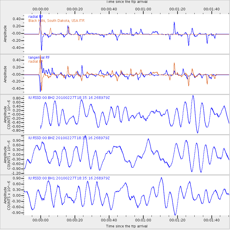
RSSD Black Hills, South Dakota, USA - Earthquake Result Viewer
*The percent match for this event was below the threshold and hence no stack was calculated.
| Earthquake location: |
Near Coast Of Central Chile |
| Earthquake latitude/longitude: |
-37.6/-73.7 |
| Earthquake time(UTC): |
2010/02/27 (058) 18:23:11 GMT |
| Earthquake Depth: |
35 km |
| Earthquake Magnitude: |
5.7 MS |
| Earthquake Catalog/Contributor: |
NEIC PDE/NEIC PDE-M |
|
| Network: |
IU Global Seismograph Network (GSN - IRIS/USGS) |
| Station: |
RSSD Black Hills, South Dakota, USA |
| Lat/Lon: |
44.12 N/104.04 W |
| Elevation: |
2090 m |
|
| Distance: |
85.8 deg |
| Az: |
338.61 deg |
| Baz: |
156.276 deg |
| Ray Param: |
$rayparam |
*The percent match for this event was below the threshold and hence was not used in the summary stack. |
|
| Radial Match: |
53.674835 % |
| Radial Bump: |
400 |
| Transverse Match: |
69.944565 % |
| Transverse Bump: |
400 |
| SOD ConfigId: |
617450 |
| Insert Time: |
2013-10-01 00:48:37.825 +0000 |
| GWidth: |
2.5 |
| Max Bumps: |
400 |
| Tol: |
0.001 |
|
Signal To Noise
| Channel | StoN | STA | LTA |
| IU:RSSD:00:BHZ:20100227T18:35:16.268979Z | 1.486097 | 5.954241E-7 | 4.0066303E-7 |
| IU:RSSD:00:BH1:20100227T18:35:16.268979Z | 1.0131712 | 4.008423E-7 | 3.9563136E-7 |
| IU:RSSD:00:BH2:20100227T18:35:16.268979Z | 1.0295533 | 4.0756683E-7 | 3.9586766E-7 |
| Arrivals |
| Ps | |
| PpPs | |
| PsPs/PpSs | |


