You are here: Home > Network List > IU - Global Seismograph Network (GSN - IRIS/USGS) Stations List
> Station RSSD Black Hills, South Dakota, USA > Earthquake Result Viewer
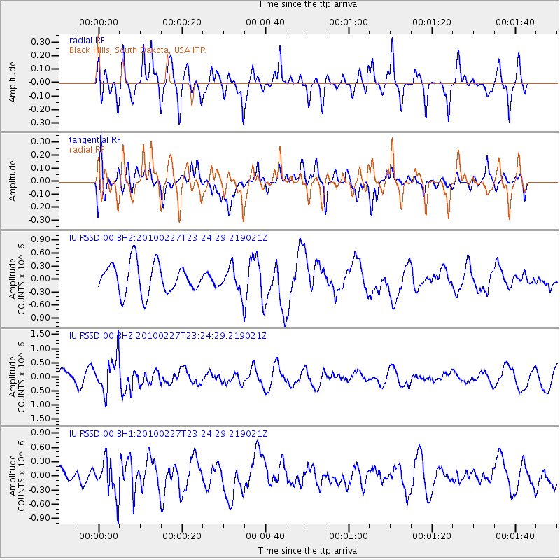
RSSD Black Hills, South Dakota, USA - Earthquake Result Viewer
*The percent match for this event was below the threshold and hence no stack was calculated.
| Earthquake location: |
Near Coast Of Central Chile |
| Earthquake latitude/longitude: |
-34.7/-71.8 |
| Earthquake time(UTC): |
2010/02/27 (058) 23:12:34 GMT |
| Earthquake Depth: |
35 km |
| Earthquake Magnitude: |
6.0 MB |
| Earthquake Catalog/Contributor: |
NEIC PDE/NEIC PDE-M |
|
| Network: |
IU Global Seismograph Network (GSN - IRIS/USGS) |
| Station: |
RSSD Black Hills, South Dakota, USA |
| Lat/Lon: |
44.12 N/104.04 W |
| Elevation: |
2090 m |
|
| Distance: |
83.7 deg |
| Az: |
337.284 deg |
| Baz: |
153.782 deg |
| Ray Param: |
$rayparam |
*The percent match for this event was below the threshold and hence was not used in the summary stack. |
|
| Radial Match: |
60.184692 % |
| Radial Bump: |
349 |
| Transverse Match: |
39.136246 % |
| Transverse Bump: |
395 |
| SOD ConfigId: |
617450 |
| Insert Time: |
2013-10-01 00:55:41.701 +0000 |
| GWidth: |
2.5 |
| Max Bumps: |
400 |
| Tol: |
0.001 |
|
Signal To Noise
| Channel | StoN | STA | LTA |
| IU:RSSD:00:BHZ:20100227T23:24:29.219021Z | 2.458857 | 6.5180905E-7 | 2.650862E-7 |
| IU:RSSD:00:BH1:20100227T23:24:29.219021Z | 1.4917532 | 3.893672E-7 | 2.6101313E-7 |
| IU:RSSD:00:BH2:20100227T23:24:29.219021Z | 0.8863806 | 3.0545436E-7 | 3.4460857E-7 |
| Arrivals |
| Ps | |
| PpPs | |
| PsPs/PpSs | |


