You are here: Home > Network List > TA - USArray Transportable Network (new EarthScope stations) Stations List
> Station G59A Clarenceville, QC, USA > Earthquake Result Viewer
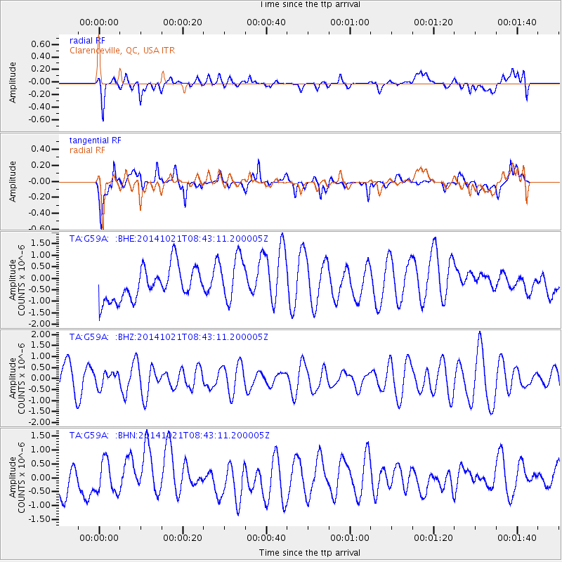
G59A Clarenceville, QC, USA - Earthquake Result Viewer
*The percent match for this event was below the threshold and hence no stack was calculated.
| Earthquake location: |
Iceland |
| Earthquake latitude/longitude: |
64.7/-17.3 |
| Earthquake time(UTC): |
2014/10/21 (294) 08:36:39 GMT |
| Earthquake Depth: |
3.1 km |
| Earthquake Magnitude: |
5.4 MW |
| Earthquake Catalog/Contributor: |
ISC/ISC |
|
| Network: |
TA USArray Transportable Network (new EarthScope stations) |
| Station: |
G59A Clarenceville, QC, USA |
| Lat/Lon: |
45.08 N/73.18 W |
| Elevation: |
36 m |
|
| Distance: |
36.1 deg |
| Az: |
264.626 deg |
| Baz: |
37.199 deg |
| Ray Param: |
$rayparam |
*The percent match for this event was below the threshold and hence was not used in the summary stack. |
|
| Radial Match: |
56.09231 % |
| Radial Bump: |
400 |
| Transverse Match: |
48.015522 % |
| Transverse Bump: |
400 |
| SOD ConfigId: |
3390531 |
| Insert Time: |
2019-04-14 16:06:33.997 +0000 |
| GWidth: |
2.5 |
| Max Bumps: |
400 |
| Tol: |
0.001 |
|
Signal To Noise
| Channel | StoN | STA | LTA |
| TA:G59A: :BHZ:20141021T08:43:11.200005Z | 0.60108656 | 3.2377034E-7 | 5.3864176E-7 |
| TA:G59A: :BHN:20141021T08:43:11.200005Z | 1.0253849 | 5.7749617E-7 | 5.631994E-7 |
| TA:G59A: :BHE:20141021T08:43:11.200005Z | 1.4115709 | 9.928056E-7 | 7.0333385E-7 |
| Arrivals |
| Ps | |
| PpPs | |
| PsPs/PpSs | |


