You are here: Home > Network List > US - United States National Seismic Network Stations List
> Station DGMT Dagmar, Montana, USA > Earthquake Result Viewer
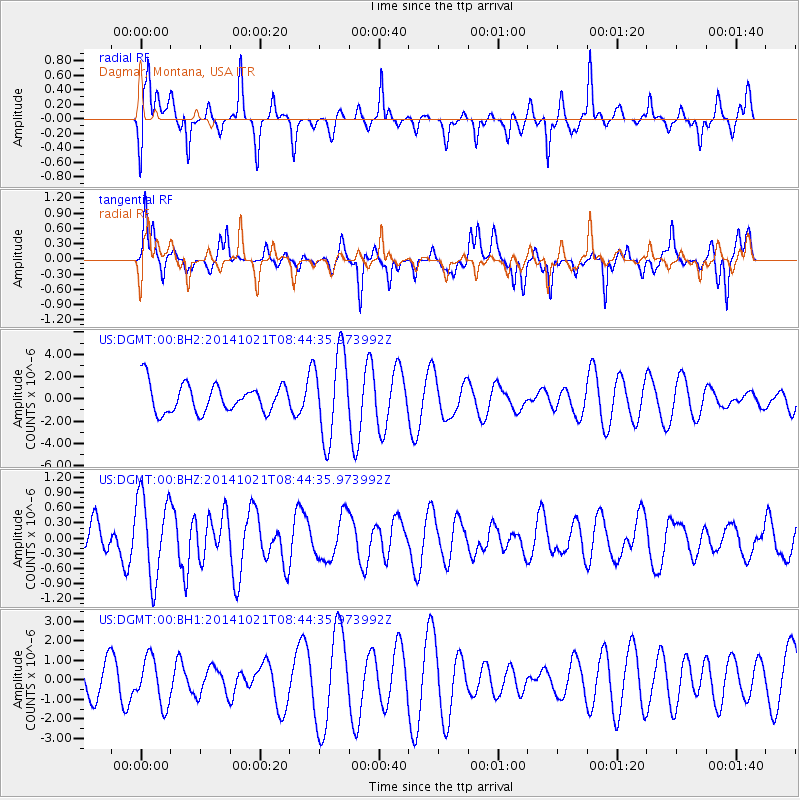
DGMT Dagmar, Montana, USA - Earthquake Result Viewer
*The percent match for this event was below the threshold and hence no stack was calculated.
| Earthquake location: |
Iceland |
| Earthquake latitude/longitude: |
64.7/-17.3 |
| Earthquake time(UTC): |
2014/10/21 (294) 08:36:39 GMT |
| Earthquake Depth: |
3.1 km |
| Earthquake Magnitude: |
5.4 MW |
| Earthquake Catalog/Contributor: |
ISC/ISC |
|
| Network: |
US United States National Seismic Network |
| Station: |
DGMT Dagmar, Montana, USA |
| Lat/Lon: |
48.47 N/104.20 W |
| Elevation: |
0.0 m |
|
| Distance: |
46.4 deg |
| Az: |
293.47 deg |
| Baz: |
36.37 deg |
| Ray Param: |
$rayparam |
*The percent match for this event was below the threshold and hence was not used in the summary stack. |
|
| Radial Match: |
50.748367 % |
| Radial Bump: |
358 |
| Transverse Match: |
37.556286 % |
| Transverse Bump: |
344 |
| SOD ConfigId: |
3390531 |
| Insert Time: |
2019-04-14 16:07:53.015 +0000 |
| GWidth: |
2.5 |
| Max Bumps: |
400 |
| Tol: |
0.001 |
|
Signal To Noise
| Channel | StoN | STA | LTA |
| US:DGMT:00:BHZ:20141021T08:44:35.973992Z | 2.4461305 | 8.3107676E-7 | 3.3975158E-7 |
| US:DGMT:00:BH1:20141021T08:44:35.973992Z | 0.78223056 | 1.1884518E-6 | 1.5193116E-6 |
| US:DGMT:00:BH2:20141021T08:44:35.973992Z | 3.078645 | 3.870491E-6 | 1.2572061E-6 |
| Arrivals |
| Ps | |
| PpPs | |
| PsPs/PpSs | |


