You are here: Home > Network List > KN - Kyrgyz Seismic Telemetry Network Stations List
> Station TKM2 - > Earthquake Result Viewer
TKM2 - - Earthquake Result Viewer
*The percent match for this event was below the threshold and hence no stack was calculated.
| Earthquake location: |
Ryukyu Islands, Japan |
| Earthquake latitude/longitude: |
27.5/128.4 |
| Earthquake time(UTC): |
2014/10/22 (295) 00:15:17 GMT |
| Earthquake Depth: |
42 km |
| Earthquake Magnitude: |
5.8 MB |
| Earthquake Catalog/Contributor: |
NEIC PDE/NEIC COMCAT |
|
| Network: |
KN Kyrgyz Seismic Telemetry Network |
| Station: |
TKM2 - |
| Lat/Lon: |
42.92 N/75.60 E |
| Elevation: |
2020 m |
|
| Distance: |
45.1 deg |
| Az: |
304.263 deg |
| Baz: |
92.152 deg |
| Ray Param: |
$rayparam |
*The percent match for this event was below the threshold and hence was not used in the summary stack. |
|
| Radial Match: |
56.304493 % |
| Radial Bump: |
400 |
| Transverse Match: |
54.152 % |
| Transverse Bump: |
400 |
| SOD ConfigId: |
3390531 |
| Insert Time: |
2019-04-14 16:16:50.957 +0000 |
| GWidth: |
2.5 |
| Max Bumps: |
400 |
| Tol: |
0.001 |
|
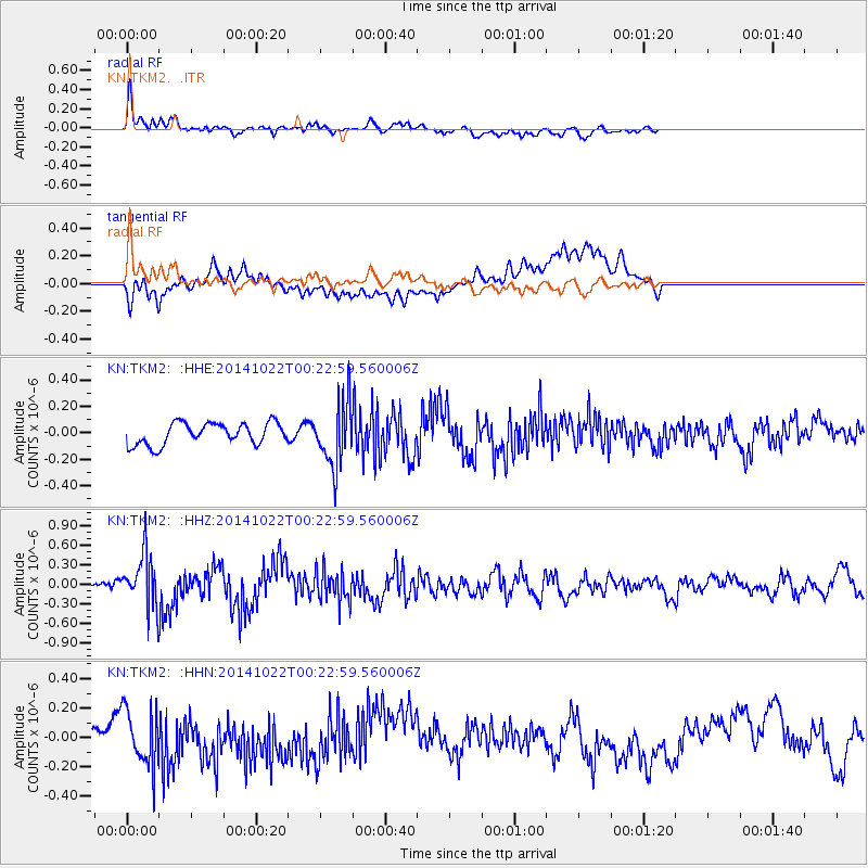
Signal To Noise
| Channel | StoN | STA | LTA |
| KN:TKM2: :HHZ:20141022T00:22:59.560006Z | 4.6937494 | 4.1460183E-7 | 8.833062E-8 |
| KN:TKM2: :HHN:20141022T00:22:59.560006Z | 1.189449 | 1.9233927E-7 | 1.6170452E-7 |
| KN:TKM2: :HHE:20141022T00:22:59.560006Z | 2.7052672 | 2.2423434E-7 | 8.288805E-8 |
| Arrivals |
| Ps | |
| PpPs | |
| PsPs/PpSs | |


