
PALK Pallekele, Sri Lanka - Earthquake Result Viewer
| ||||||||||||||||||
| ||||||||||||||||||
| ||||||||||||||||||
|
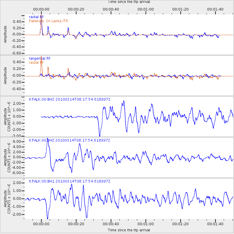
Signal To Noise
| Channel | StoN | STA | LTA |
| II:PALK:00:BHZ:20100314T08:17:54.618997Z | 32.281357 | 3.2312757E-6 | 1.00097274E-7 |
| II:PALK:00:BH1:20100314T08:17:54.618997Z | 16.758902 | 1.0520218E-6 | 6.2773914E-8 |
| II:PALK:00:BH2:20100314T08:17:54.618997Z | 16.55895 | 1.2819137E-6 | 7.741515E-8 |
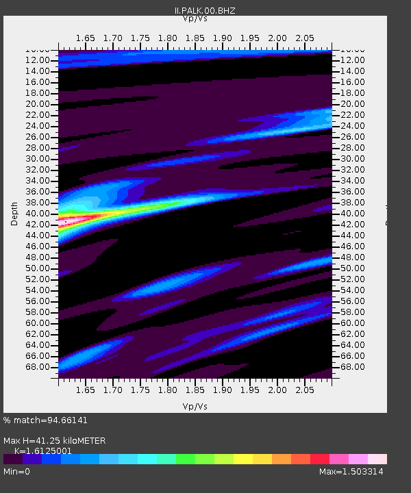
| Arrivals | |
| Ps | 4.1 SECOND |
| PpPs | 16 SECOND |
| PsPs/PpSs | 20 SECOND |

