You are here: Home > Network List > AV - Alaska Volcano Observatory Stations List
> Station SPCR Ckakachatna River, Mount Spurr, Alaska > Earthquake Result Viewer
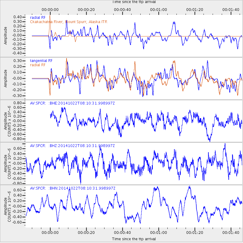
SPCR Ckakachatna River, Mount Spurr, Alaska - Earthquake Result Viewer
*The percent match for this event was below the threshold and hence no stack was calculated.
| Earthquake location: |
Northern Molucca Sea |
| Earthquake latitude/longitude: |
2.9/126.6 |
| Earthquake time(UTC): |
2014/10/22 (295) 07:58:37 GMT |
| Earthquake Depth: |
10 km |
| Earthquake Magnitude: |
4.0 mb |
| Earthquake Catalog/Contributor: |
ISC/ISC |
|
| Network: |
AV Alaska Volcano Observatory |
| Station: |
SPCR Ckakachatna River, Mount Spurr, Alaska |
| Lat/Lon: |
61.20 N/152.21 W |
| Elevation: |
984 m |
|
| Distance: |
83.2 deg |
| Az: |
28.814 deg |
| Baz: |
263.728 deg |
| Ray Param: |
$rayparam |
*The percent match for this event was below the threshold and hence was not used in the summary stack. |
|
| Radial Match: |
53.992107 % |
| Radial Bump: |
400 |
| Transverse Match: |
53.35265 % |
| Transverse Bump: |
400 |
| SOD ConfigId: |
3390531 |
| Insert Time: |
2019-04-14 16:27:25.009 +0000 |
| GWidth: |
2.5 |
| Max Bumps: |
400 |
| Tol: |
0.001 |
|
Signal To Noise
| Channel | StoN | STA | LTA |
| AV:SPCR: :BHZ:20141022T08:10:31.998997Z | 0.8888366 | 1.5984077E-7 | 1.7983143E-7 |
| AV:SPCR: :BHN:20141022T08:10:31.998997Z | 1.0836095 | 1.941956E-7 | 1.792118E-7 |
| AV:SPCR: :BHE:20141022T08:10:31.998997Z | 1.5414852 | 3.3678148E-7 | 2.1847858E-7 |
| Arrivals |
| Ps | |
| PpPs | |
| PsPs/PpSs | |


