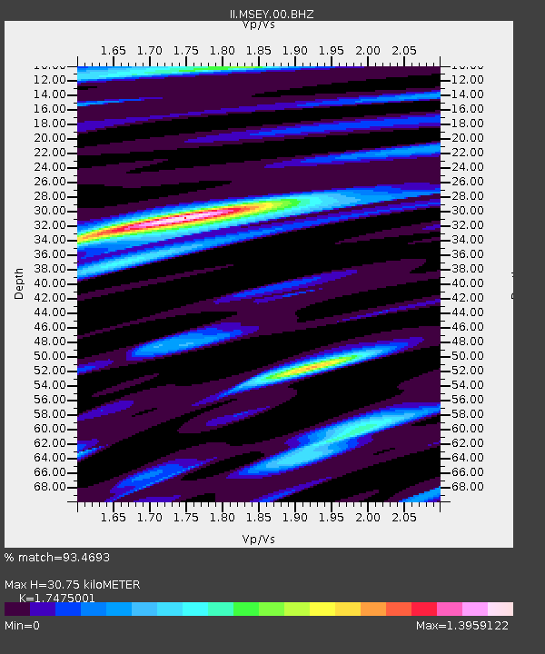
MSEY Mahe, Seychelles - Earthquake Result Viewer
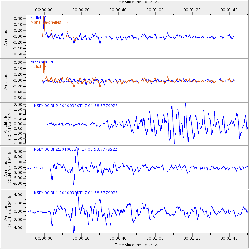
Earthquake location: Andaman Islands, India Region
Earthquake latitude/longitude: 13.7/92.8
Earthquake time(UTC): 2010/03/30 (089) 16:54:46 GMT
Earthquake Depth: 34 km
Earthquake Magnitude: 6.5 MB, 6.3 MS, 6.7 MW, 6.6 MW
Earthquake Catalog/Contributor: WHDF/NEIC
Network: II Global Seismograph Network (GSN - IRIS/IDA)
Station: MSEY Mahe, Seychelles
Lat/Lon: 4.67 S/55.48 E
Elevation: 475 m
Distance: 41.3 deg
Az: 246.36 deg
Baz: 63.304 deg
Ray Param: 0.07380286
Estimated Moho Depth: 30.75 km
Estimated Crust Vp/Vs: 1.75
Assumed Crust Vp: 6.303 km/s
Estimated Crust Vs: 3.607 km/s
Estimated Crust Poisson's Ratio: 0.26
Radial Match: 93.4693 %
Radial Bump: 346
Transverse Match: 88.09374 %
Transverse Bump: 400
SOD ConfigId: 617450
Insert Time: 2013-10-01 03:15:02.027 +0000
GWidth: 2.5
Max Bumps: 400
Tol: 0.001

Signal To Noise

ChannelStoNSTALTA
II:MSEY:00:BHZ:20100330T17:01:58.577992Z11.03941252.327022E-62.107922E-7
II:MSEY:00:BH1:20100330T17:01:58.577992Z9.8916451.1944039E-61.2074875E-7
II:MSEY:00:BH2:20100330T17:01:58.577992Z2.4592091.7844884E-77.2563516E-8
Arrivals
Ps3.9 SECOND
PpPs13 SECOND
PsPs/PpSs16 SECOND