You are here: Home > Network List > IU - Global Seismograph Network (GSN - IRIS/USGS) Stations List
> Station JOHN Johnston Island, USA > Earthquake Result Viewer
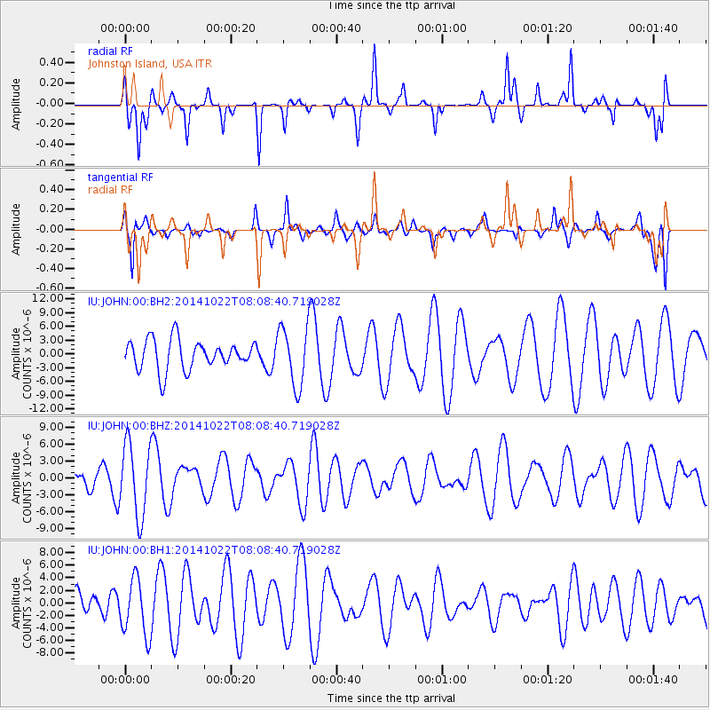
JOHN Johnston Island, USA - Earthquake Result Viewer
*The percent match for this event was below the threshold and hence no stack was calculated.
| Earthquake location: |
Northern Molucca Sea |
| Earthquake latitude/longitude: |
2.9/126.6 |
| Earthquake time(UTC): |
2014/10/22 (295) 07:58:37 GMT |
| Earthquake Depth: |
10 km |
| Earthquake Magnitude: |
4.0 mb |
| Earthquake Catalog/Contributor: |
ISC/ISC |
|
| Network: |
IU Global Seismograph Network (GSN - IRIS/USGS) |
| Station: |
JOHN Johnston Island, USA |
| Lat/Lon: |
16.73 N/169.53 W |
| Elevation: |
2.0 m |
|
| Distance: |
64.2 deg |
| Az: |
72.927 deg |
| Baz: |
265.104 deg |
| Ray Param: |
$rayparam |
*The percent match for this event was below the threshold and hence was not used in the summary stack. |
|
| Radial Match: |
54.07379 % |
| Radial Bump: |
266 |
| Transverse Match: |
49.44027 % |
| Transverse Bump: |
400 |
| SOD ConfigId: |
3390531 |
| Insert Time: |
2019-04-14 16:27:58.534 +0000 |
| GWidth: |
2.5 |
| Max Bumps: |
400 |
| Tol: |
0.001 |
|
Signal To Noise
| Channel | StoN | STA | LTA |
| IU:JOHN:00:BHZ:20141022T08:08:40.719028Z | 3.5545702 | 6.5107242E-6 | 1.8316488E-6 |
| IU:JOHN:00:BH1:20141022T08:08:40.719028Z | 0.95636845 | 4.5827355E-6 | 4.7918093E-6 |
| IU:JOHN:00:BH2:20141022T08:08:40.719028Z | 2.0261712 | 6.5926583E-6 | 3.2537519E-6 |
| Arrivals |
| Ps | |
| PpPs | |
| PsPs/PpSs | |


