You are here: Home > Network List > CU - Caribbean Network (USGS) Stations List
> Station BBGH Gun Hill, Barbados > Earthquake Result Viewer
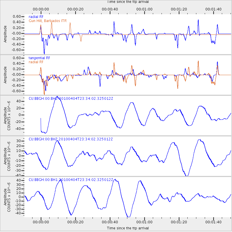
BBGH Gun Hill, Barbados - Earthquake Result Viewer
*The percent match for this event was below the threshold and hence no stack was calculated.
| Earthquake location: |
Calif.-Baja Calif. Border Region |
| Earthquake latitude/longitude: |
32.2/-115.3 |
| Earthquake time(UTC): |
2010/04/04 (094) 23:25:07 GMT |
| Earthquake Depth: |
6.0 km |
| Earthquake Magnitude: |
5.7 MD |
| Earthquake Catalog/Contributor: |
NEIC PDE/NEIC PDE-M |
|
| Network: |
CU Caribbean Network (USGS) |
| Station: |
BBGH Gun Hill, Barbados |
| Lat/Lon: |
13.14 N/59.56 W |
| Elevation: |
180 m |
|
| Distance: |
54.2 deg |
| Az: |
97.064 deg |
| Baz: |
300.314 deg |
| Ray Param: |
$rayparam |
*The percent match for this event was below the threshold and hence was not used in the summary stack. |
|
| Radial Match: |
55.85176 % |
| Radial Bump: |
400 |
| Transverse Match: |
41.616245 % |
| Transverse Bump: |
313 |
| SOD ConfigId: |
617450 |
| Insert Time: |
2013-10-01 03:26:33.409 +0000 |
| GWidth: |
2.5 |
| Max Bumps: |
400 |
| Tol: |
0.001 |
|
Signal To Noise
| Channel | StoN | STA | LTA |
| CU:BBGH:00:BHZ:20100404T23:34:02.325012Z | 2.2988796 | 2.0865453E-5 | 9.076357E-6 |
| CU:BBGH:00:BH1:20100404T23:34:02.325012Z | 0.7898319 | 1.823769E-5 | 2.3090597E-5 |
| CU:BBGH:00:BH2:20100404T23:34:02.325012Z | 0.2883071 | 9.483495E-6 | 3.2893728E-5 |
| Arrivals |
| Ps | |
| PpPs | |
| PsPs/PpSs | |


