You are here: Home > Network List > II - Global Seismograph Network (GSN - IRIS/IDA) Stations List
> Station MSEY Mahe, Seychelles > Earthquake Result Viewer
MSEY Mahe, Seychelles - Earthquake Result Viewer

| Earthquake location: |
Southern Molucca Sea |
| Earthquake latitude/longitude: |
-0.2/125.0 |
| Earthquake time(UTC): |
2010/04/05 (095) 10:05:44 GMT |
| Earthquake Depth: |
25 km |
| Earthquake Magnitude: |
6.1 MW, 5.6 MS, 6.1 MB, 6.2 MW |
| Earthquake Catalog/Contributor: |
NEIC PDE/NEIC PDE-M |
|
| Network: |
II Global Seismograph Network (GSN - IRIS/IDA) |
| Station: |
MSEY Mahe, Seychelles |
| Lat/Lon: |
4.67 S/55.48 E |
| Elevation: |
475 m |
|
| Distance: |
69.6 deg |
| Az: |
265.113 deg |
| Baz: |
88.463 deg |
| Ray Param: |
0.055518135 |
| Estimated Moho Depth: |
23.0 km |
| Estimated Crust Vp/Vs: |
2.10 |
| Assumed Crust Vp: |
6.303 km/s |
| Estimated Crust Vs: |
3.005 km/s |
| Estimated Crust Poisson's Ratio: |
0.35 |
|
| Radial Match: |
85.96191 % |
| Radial Bump: |
377 |
| Transverse Match: |
72.40317 % |
| Transverse Bump: |
400 |
| SOD ConfigId: |
617450 |
| Insert Time: |
2013-10-01 03:27:58.340 +0000 |
| GWidth: |
2.5 |
| Max Bumps: |
400 |
| Tol: |
0.001 |
|
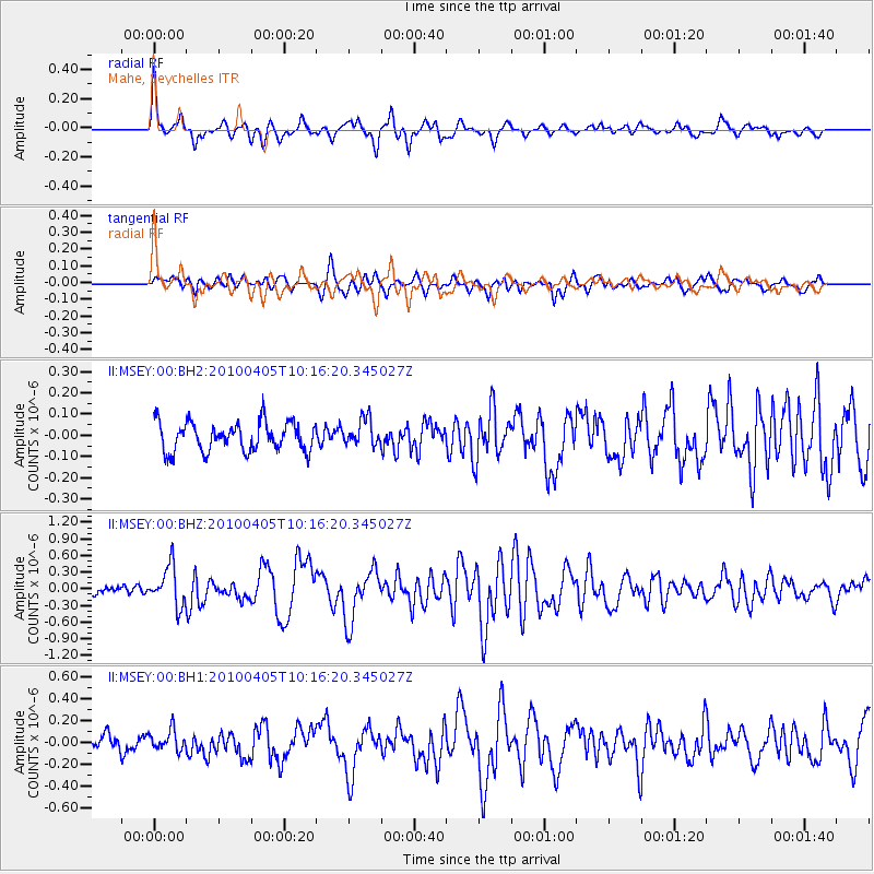
Signal To Noise
| Channel | StoN | STA | LTA |
| II:MSEY:00:BHZ:20100405T10:16:20.345027Z | 3.8167996 | 3.5397323E-7 | 9.274085E-8 |
| II:MSEY:00:BH1:20100405T10:16:20.345027Z | 1.1564368 | 9.3050595E-8 | 8.0463195E-8 |
| II:MSEY:00:BH2:20100405T10:16:20.345027Z | 0.9277671 | 6.30542E-8 | 6.79634E-8 |
| Arrivals |
| Ps | 4.1 SECOND |
| PpPs | 11 SECOND |
| PsPs/PpSs | 15 SECOND |


