
KURK Kurchatov, Kazakhstan - Earthquake Result Viewer
| ||||||||||||||||||
| ||||||||||||||||||
| ||||||||||||||||||
|
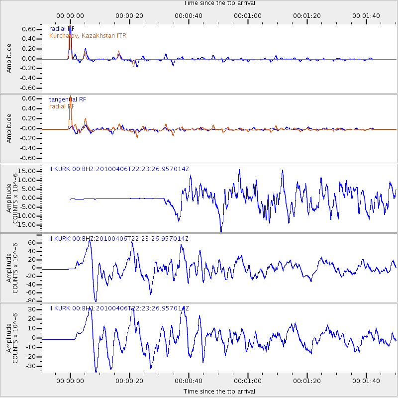
Signal To Noise
| Channel | StoN | STA | LTA |
| II:KURK:00:BHZ:20100406T22:23:26.957014Z | 29.506569 | 1.1881213E-5 | 4.0266332E-7 |
| II:KURK:00:BH1:20100406T22:23:26.957014Z | 22.799587 | 5.5686105E-6 | 2.4424173E-7 |
| II:KURK:00:BH2:20100406T22:23:26.957014Z | 15.438561 | 1.997079E-6 | 1.2935654E-7 |
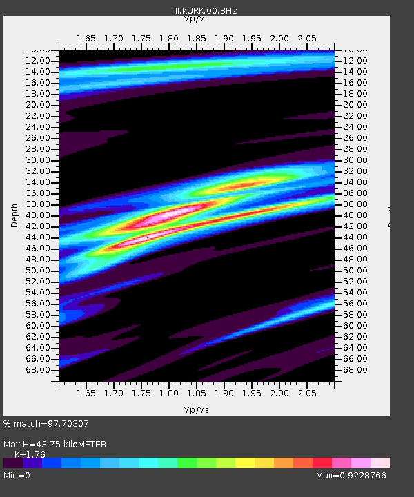
| Arrivals | |
| Ps | 5.4 SECOND |
| PpPs | 17 SECOND |
| PsPs/PpSs | 23 SECOND |

