
KEV Kevo, Finland - Earthquake Result Viewer
| ||||||||||||||||||
| ||||||||||||||||||
| ||||||||||||||||||
|
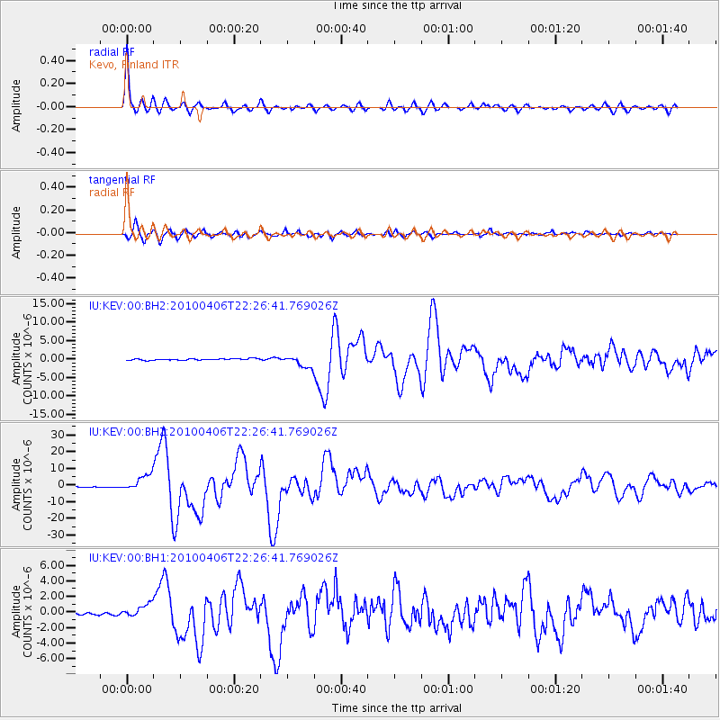
Signal To Noise
| Channel | StoN | STA | LTA |
| IU:KEV:00:BHZ:20100406T22:26:41.769026Z | 14.43759 | 4.7961676E-6 | 3.3220002E-7 |
| IU:KEV:00:BH1:20100406T22:26:41.769026Z | 5.232086 | 8.3279906E-7 | 1.591715E-7 |
| IU:KEV:00:BH2:20100406T22:26:41.769026Z | 7.6263843 | 1.5979389E-6 | 2.0952771E-7 |
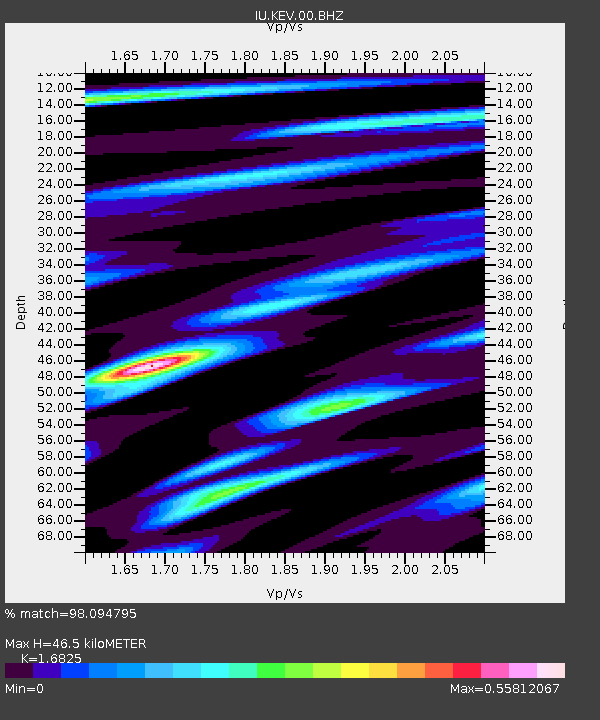
| Arrivals | |
| Ps | 4.9 SECOND |
| PpPs | 18 SECOND |
| PsPs/PpSs | 23 SECOND |

