You are here: Home > Network List > IU - Global Seismograph Network (GSN - IRIS/USGS) Stations List
> Station RSSD Black Hills, South Dakota, USA > Earthquake Result Viewer
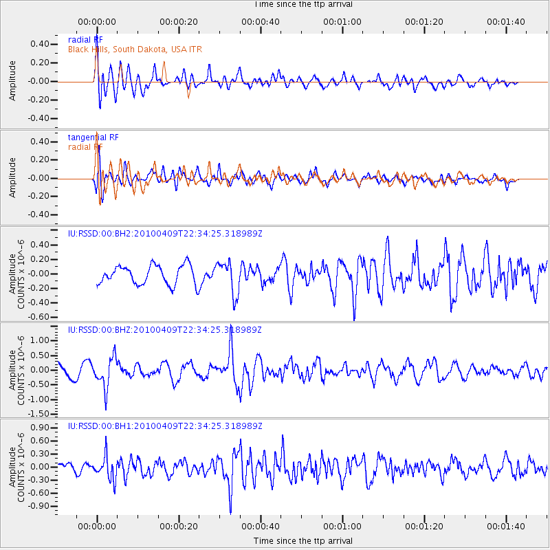
RSSD Black Hills, South Dakota, USA - Earthquake Result Viewer
*The percent match for this event was below the threshold and hence no stack was calculated.
| Earthquake location: |
La Rioja Province, Argentina |
| Earthquake latitude/longitude: |
-28.6/-68.1 |
| Earthquake time(UTC): |
2010/04/09 (099) 22:23:02 GMT |
| Earthquake Depth: |
118 km |
| Earthquake Magnitude: |
5.7 MW, 5.8 MB, 5.8 MW |
| Earthquake Catalog/Contributor: |
NEIC PDE/NEIC PDE-M |
|
| Network: |
IU Global Seismograph Network (GSN - IRIS/USGS) |
| Station: |
RSSD Black Hills, South Dakota, USA |
| Lat/Lon: |
44.12 N/104.04 W |
| Elevation: |
2090 m |
|
| Distance: |
79.4 deg |
| Az: |
334.552 deg |
| Baz: |
148.343 deg |
| Ray Param: |
$rayparam |
*The percent match for this event was below the threshold and hence was not used in the summary stack. |
|
| Radial Match: |
67.303444 % |
| Radial Bump: |
400 |
| Transverse Match: |
71.26074 % |
| Transverse Bump: |
400 |
| SOD ConfigId: |
617450 |
| Insert Time: |
2013-10-01 03:36:25.747 +0000 |
| GWidth: |
2.5 |
| Max Bumps: |
400 |
| Tol: |
0.001 |
|
Signal To Noise
| Channel | StoN | STA | LTA |
| IU:RSSD:00:BHZ:20100409T22:34:25.318989Z | 2.5117567 | 5.223889E-7 | 2.0797752E-7 |
| IU:RSSD:00:BH1:20100409T22:34:25.318989Z | 2.2594118 | 2.7168173E-7 | 1.2024445E-7 |
| IU:RSSD:00:BH2:20100409T22:34:25.318989Z | 1.7704343 | 2.2884075E-7 | 1.2925685E-7 |
| Arrivals |
| Ps | |
| PpPs | |
| PsPs/PpSs | |


