You are here: Home > Network List > IU - Global Seismograph Network (GSN - IRIS/USGS) Stations List
> Station RSSD Black Hills, South Dakota, USA > Earthquake Result Viewer
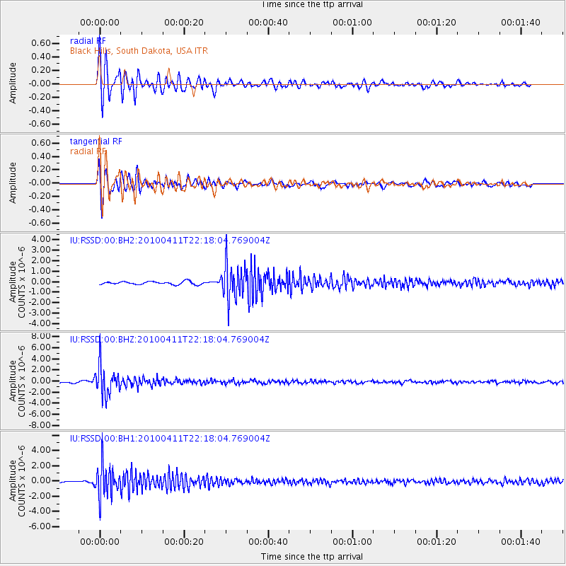
RSSD Black Hills, South Dakota, USA - Earthquake Result Viewer
*The percent match for this event was below the threshold and hence no stack was calculated.
| Earthquake location: |
Strait Of Gibraltar |
| Earthquake latitude/longitude: |
37.0/-3.5 |
| Earthquake time(UTC): |
2010/04/11 (101) 22:08:12 GMT |
| Earthquake Depth: |
610 km |
| Earthquake Magnitude: |
6.3 MW, 6.0 MB, 6.3 MW |
| Earthquake Catalog/Contributor: |
NEIC PDE/NEIC PDE-M |
|
| Network: |
IU Global Seismograph Network (GSN - IRIS/USGS) |
| Station: |
RSSD Black Hills, South Dakota, USA |
| Lat/Lon: |
44.12 N/104.04 W |
| Elevation: |
2090 m |
|
| Distance: |
71.9 deg |
| Az: |
311.847 deg |
| Baz: |
55.939 deg |
| Ray Param: |
$rayparam |
*The percent match for this event was below the threshold and hence was not used in the summary stack. |
|
| Radial Match: |
88.550606 % |
| Radial Bump: |
400 |
| Transverse Match: |
83.170654 % |
| Transverse Bump: |
400 |
| SOD ConfigId: |
617450 |
| Insert Time: |
2013-10-01 03:51:31.773 +0000 |
| GWidth: |
2.5 |
| Max Bumps: |
400 |
| Tol: |
0.001 |
|
Signal To Noise
| Channel | StoN | STA | LTA |
| IU:RSSD:00:BHZ:20100411T22:18:04.769004Z | 16.243675 | 2.6808475E-6 | 1.6503947E-7 |
| IU:RSSD:00:BH1:20100411T22:18:04.769004Z | 20.300318 | 2.124004E-6 | 1.046291E-7 |
| IU:RSSD:00:BH2:20100411T22:18:04.769004Z | 12.060581 | 1.698611E-6 | 1.4083989E-7 |
| Arrivals |
| Ps | |
| PpPs | |
| PsPs/PpSs | |


