You are here: Home > Network List > II - Global Seismograph Network (GSN - IRIS/IDA) Stations List
> Station KURK Kurchatov, Kazakhstan > Earthquake Result Viewer
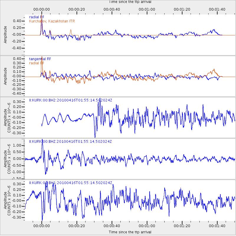
KURK Kurchatov, Kazakhstan - Earthquake Result Viewer
*The percent match for this event was below the threshold and hence no stack was calculated.
| Earthquake location: |
Alaska Peninsula |
| Earthquake latitude/longitude: |
54.5/-161.0 |
| Earthquake time(UTC): |
2010/04/16 (106) 01:45:15 GMT |
| Earthquake Depth: |
34 km |
| Earthquake Magnitude: |
5.7 MW, 5.6 MB, 5.7 MW |
| Earthquake Catalog/Contributor: |
NEIC PDE/NEIC PDE-M |
|
| Network: |
II Global Seismograph Network (GSN - IRIS/IDA) |
| Station: |
KURK Kurchatov, Kazakhstan |
| Lat/Lon: |
50.72 N/78.62 E |
| Elevation: |
184 m |
|
| Distance: |
63.9 deg |
| Az: |
322.352 deg |
| Baz: |
34.1 deg |
| Ray Param: |
$rayparam |
*The percent match for this event was below the threshold and hence was not used in the summary stack. |
|
| Radial Match: |
65.86809 % |
| Radial Bump: |
400 |
| Transverse Match: |
68.80936 % |
| Transverse Bump: |
400 |
| SOD ConfigId: |
617450 |
| Insert Time: |
2013-10-01 04:04:17.344 +0000 |
| GWidth: |
2.5 |
| Max Bumps: |
400 |
| Tol: |
0.001 |
|
Signal To Noise
| Channel | StoN | STA | LTA |
| II:KURK:00:BHZ:20100416T01:55:14.502024Z | 13.347831 | 6.960609E-7 | 5.2147865E-8 |
| II:KURK:00:BH1:20100416T01:55:14.502024Z | 2.6134334 | 2.3188885E-7 | 8.872958E-8 |
| II:KURK:00:BH2:20100416T01:55:14.502024Z | 3.813295 | 2.0416294E-7 | 5.353977E-8 |
| Arrivals |
| Ps | |
| PpPs | |
| PsPs/PpSs | |


