You are here: Home > Network List > IU - Global Seismograph Network (GSN - IRIS/USGS) Stations List
> Station RSSD Black Hills, South Dakota, USA > Earthquake Result Viewer
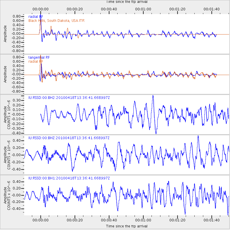
RSSD Black Hills, South Dakota, USA - Earthquake Result Viewer
*The percent match for this event was below the threshold and hence no stack was calculated.
| Earthquake location: |
Guatemala |
| Earthquake latitude/longitude: |
14.5/-92.0 |
| Earthquake time(UTC): |
2010/04/18 (108) 13:30:58 GMT |
| Earthquake Depth: |
64 km |
| Earthquake Magnitude: |
5.6 MW, 5.6 MW |
| Earthquake Catalog/Contributor: |
NEIC PDE/NEIC PDE-M |
|
| Network: |
IU Global Seismograph Network (GSN - IRIS/USGS) |
| Station: |
RSSD Black Hills, South Dakota, USA |
| Lat/Lon: |
44.12 N/104.04 W |
| Elevation: |
2090 m |
|
| Distance: |
31.2 deg |
| Az: |
343.154 deg |
| Baz: |
157.063 deg |
| Ray Param: |
$rayparam |
*The percent match for this event was below the threshold and hence was not used in the summary stack. |
|
| Radial Match: |
64.33709 % |
| Radial Bump: |
400 |
| Transverse Match: |
54.91706 % |
| Transverse Bump: |
400 |
| SOD ConfigId: |
617450 |
| Insert Time: |
2013-10-01 04:13:11.251 +0000 |
| GWidth: |
2.5 |
| Max Bumps: |
400 |
| Tol: |
0.001 |
|
Signal To Noise
| Channel | StoN | STA | LTA |
| IU:RSSD:00:BHZ:20100418T13:36:41.668997Z | 1.4668212 | 1.3239502E-7 | 9.025981E-8 |
| IU:RSSD:00:BH1:20100418T13:36:41.668997Z | 2.186484 | 1.6160568E-7 | 7.391121E-8 |
| IU:RSSD:00:BH2:20100418T13:36:41.668997Z | 1.6764234 | 1.614693E-7 | 9.631773E-8 |
| Arrivals |
| Ps | |
| PpPs | |
| PsPs/PpSs | |


