You are here: Home > Network List > US - United States National Seismic Network Stations List
> Station HAWA Hanford, Washington, USA > Earthquake Result Viewer
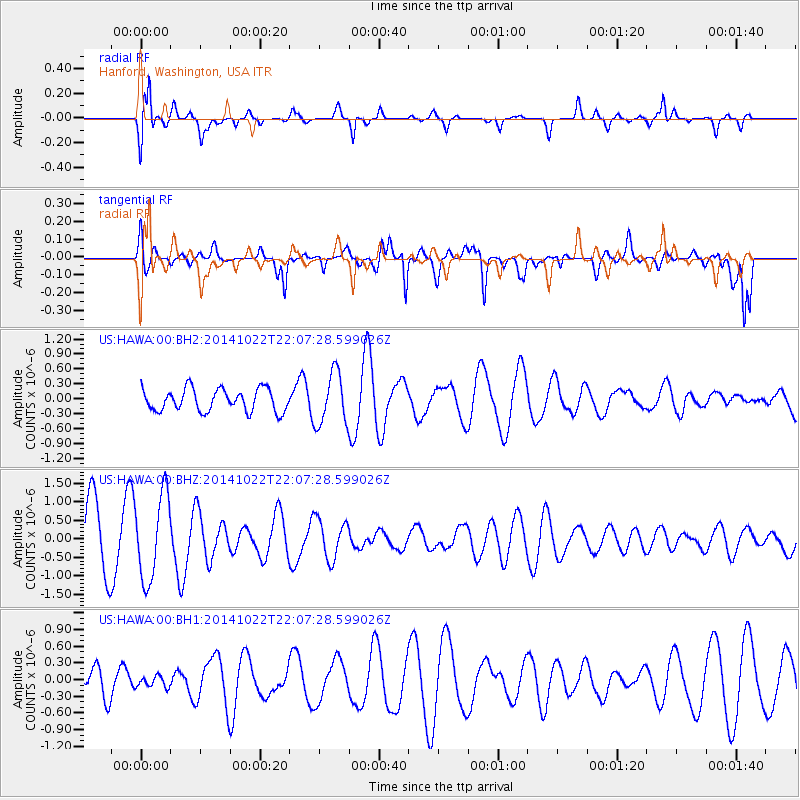
HAWA Hanford, Washington, USA - Earthquake Result Viewer
*The percent match for this event was below the threshold and hence no stack was calculated.
| Earthquake location: |
Northern Mid-Atlantic Ridge |
| Earthquake latitude/longitude: |
15.0/-44.9 |
| Earthquake time(UTC): |
2014/10/22 (295) 21:56:56 GMT |
| Earthquake Depth: |
12 km |
| Earthquake Magnitude: |
4.9 MW |
| Earthquake Catalog/Contributor: |
ISC/ISC |
|
| Network: |
US United States National Seismic Network |
| Station: |
HAWA Hanford, Washington, USA |
| Lat/Lon: |
46.39 N/119.53 W |
| Elevation: |
364 m |
|
| Distance: |
68.7 deg |
| Az: |
314.255 deg |
| Baz: |
90.417 deg |
| Ray Param: |
$rayparam |
*The percent match for this event was below the threshold and hence was not used in the summary stack. |
|
| Radial Match: |
76.26187 % |
| Radial Bump: |
400 |
| Transverse Match: |
67.42615 % |
| Transverse Bump: |
400 |
| SOD ConfigId: |
3390531 |
| Insert Time: |
2019-04-14 16:37:34.613 +0000 |
| GWidth: |
2.5 |
| Max Bumps: |
400 |
| Tol: |
0.001 |
|
Signal To Noise
| Channel | StoN | STA | LTA |
| US:HAWA:00:BHZ:20141022T22:07:28.599026Z | 1.6366817 | 1.1400535E-6 | 6.9656403E-7 |
| US:HAWA:00:BH1:20141022T22:07:28.599026Z | 0.34050956 | 1.0013034E-7 | 2.940603E-7 |
| US:HAWA:00:BH2:20141022T22:07:28.599026Z | 2.3215163 | 5.2250346E-7 | 2.250699E-7 |
| Arrivals |
| Ps | |
| PpPs | |
| PsPs/PpSs | |


