You are here: Home > Network List > IU - Global Seismograph Network (GSN - IRIS/USGS) Stations List
> Station HNR Honiara, Solomon Islands > Earthquake Result Viewer
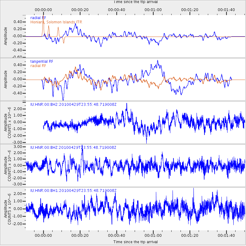
HNR Honiara, Solomon Islands - Earthquake Result Viewer
*The percent match for this event was below the threshold and hence no stack was calculated.
| Earthquake location: |
Western Indian-Antarctic Ridge |
| Earthquake latitude/longitude: |
-51.0/139.4 |
| Earthquake time(UTC): |
2010/04/29 (119) 23:48:07 GMT |
| Earthquake Depth: |
24 km |
| Earthquake Magnitude: |
5.7 MB, 5.6 MS, 5.8 MW, 5.7 MW |
| Earthquake Catalog/Contributor: |
WHDF/NEIC |
|
| Network: |
IU Global Seismograph Network (GSN - IRIS/USGS) |
| Station: |
HNR Honiara, Solomon Islands |
| Lat/Lon: |
9.44 S/159.95 E |
| Elevation: |
100 m |
|
| Distance: |
44.8 deg |
| Az: |
29.456 deg |
| Baz: |
198.348 deg |
| Ray Param: |
$rayparam |
*The percent match for this event was below the threshold and hence was not used in the summary stack. |
|
| Radial Match: |
47.792103 % |
| Radial Bump: |
400 |
| Transverse Match: |
35.988136 % |
| Transverse Bump: |
400 |
| SOD ConfigId: |
617450 |
| Insert Time: |
2013-10-01 04:30:42.160 +0000 |
| GWidth: |
2.5 |
| Max Bumps: |
400 |
| Tol: |
0.001 |
|
Signal To Noise
| Channel | StoN | STA | LTA |
| IU:HNR:00:BHZ:20100429T23:55:48.719008Z | 2.045761 | 7.381377E-7 | 3.6081326E-7 |
| IU:HNR:00:BH1:20100429T23:55:48.719008Z | 2.1377797 | 9.932917E-7 | 4.6463708E-7 |
| IU:HNR:00:BH2:20100429T23:55:48.719008Z | 2.1467543 | 7.8938325E-7 | 3.6771013E-7 |
| Arrivals |
| Ps | |
| PpPs | |
| PsPs/PpSs | |


