You are here: Home > Network List > IU - Global Seismograph Network (GSN - IRIS/USGS) Stations List
> Station RSSD Black Hills, South Dakota, USA > Earthquake Result Viewer
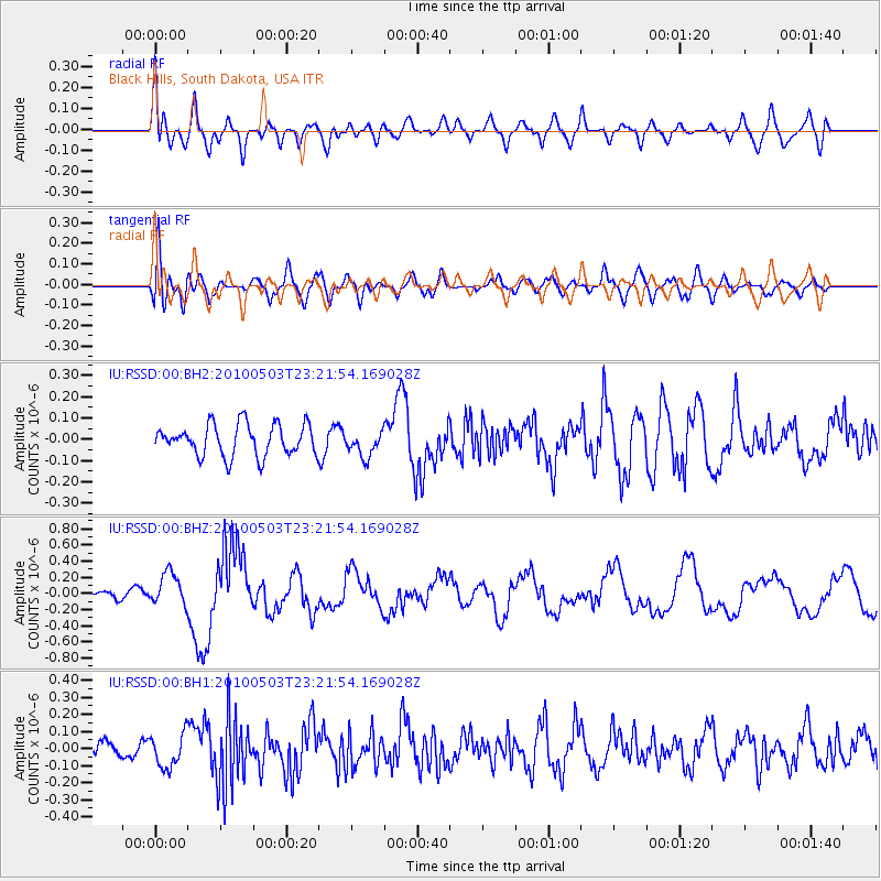
RSSD Black Hills, South Dakota, USA - Earthquake Result Viewer
*The percent match for this event was below the threshold and hence no stack was calculated.
| Earthquake location: |
Near Coast Of Central Chile |
| Earthquake latitude/longitude: |
-38.1/-73.5 |
| Earthquake time(UTC): |
2010/05/03 (123) 23:09:44 GMT |
| Earthquake Depth: |
19 km |
| Earthquake Magnitude: |
6.2 MW, 5.8 MB, 6.0 MS, 6.3 MW |
| Earthquake Catalog/Contributor: |
NEIC PDE/NEIC PDE-M |
|
| Network: |
IU Global Seismograph Network (GSN - IRIS/USGS) |
| Station: |
RSSD Black Hills, South Dakota, USA |
| Lat/Lon: |
44.12 N/104.04 W |
| Elevation: |
2090 m |
|
| Distance: |
86.4 deg |
| Az: |
338.46 deg |
| Baz: |
156.275 deg |
| Ray Param: |
$rayparam |
*The percent match for this event was below the threshold and hence was not used in the summary stack. |
|
| Radial Match: |
65.10901 % |
| Radial Bump: |
400 |
| Transverse Match: |
65.87735 % |
| Transverse Bump: |
400 |
| SOD ConfigId: |
617450 |
| Insert Time: |
2013-10-01 04:41:51.918 +0000 |
| GWidth: |
2.5 |
| Max Bumps: |
400 |
| Tol: |
0.001 |
|
Signal To Noise
| Channel | StoN | STA | LTA |
| IU:RSSD:00:BHZ:20100503T23:21:54.169028Z | 2.8647182 | 2.0372104E-7 | 7.111381E-8 |
| IU:RSSD:00:BH1:20100503T23:21:54.169028Z | 2.3110075 | 9.9536976E-8 | 4.3070813E-8 |
| IU:RSSD:00:BH2:20100503T23:21:54.169028Z | 0.8108859 | 5.956718E-8 | 7.345938E-8 |
| Arrivals |
| Ps | |
| PpPs | |
| PsPs/PpSs | |


