You are here: Home > Network List > IU - Global Seismograph Network (GSN - IRIS/USGS) Stations List
> Station HNR Honiara, Solomon Islands > Earthquake Result Viewer
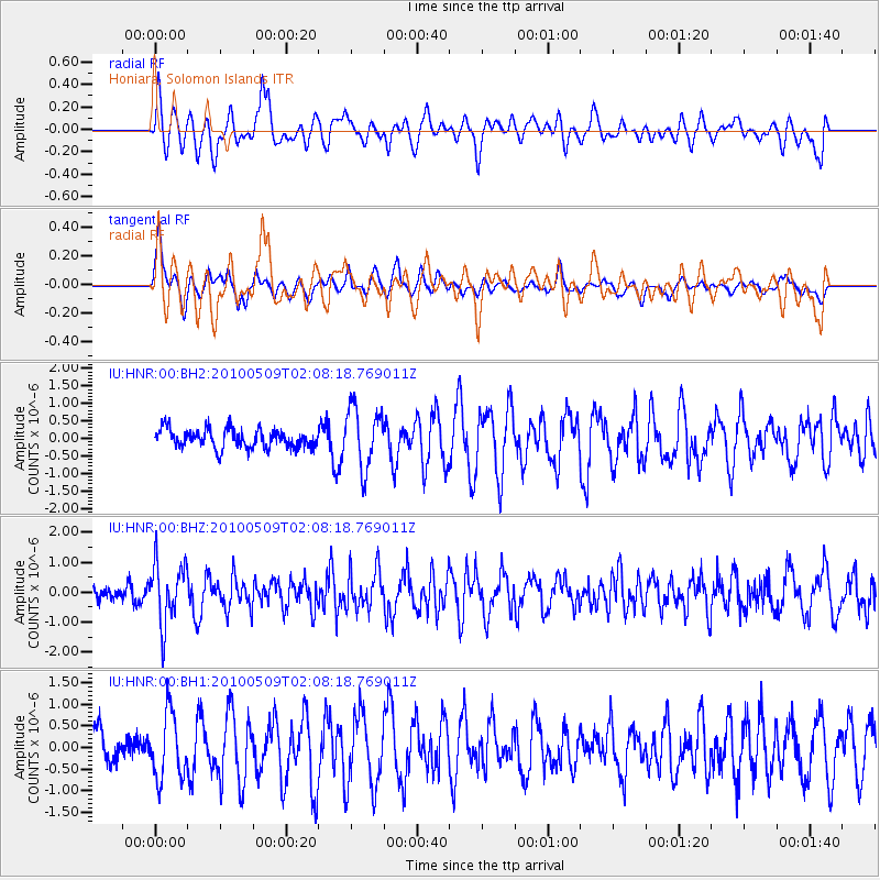
HNR Honiara, Solomon Islands - Earthquake Result Viewer
*The percent match for this event was below the threshold and hence no stack was calculated.
| Earthquake location: |
Timor Sea |
| Earthquake latitude/longitude: |
-8.2/128.9 |
| Earthquake time(UTC): |
2010/05/09 (129) 02:02:37 GMT |
| Earthquake Depth: |
37 km |
| Earthquake Magnitude: |
5.5 MB |
| Earthquake Catalog/Contributor: |
NEIC PDE/NEIC PDE-M |
|
| Network: |
IU Global Seismograph Network (GSN - IRIS/USGS) |
| Station: |
HNR Honiara, Solomon Islands |
| Lat/Lon: |
9.44 S/159.95 E |
| Elevation: |
100 m |
|
| Distance: |
30.7 deg |
| Az: |
94.715 deg |
| Baz: |
269.883 deg |
| Ray Param: |
$rayparam |
*The percent match for this event was below the threshold and hence was not used in the summary stack. |
|
| Radial Match: |
59.818554 % |
| Radial Bump: |
400 |
| Transverse Match: |
47.212845 % |
| Transverse Bump: |
378 |
| SOD ConfigId: |
617450 |
| Insert Time: |
2013-10-01 04:58:47.816 +0000 |
| GWidth: |
2.5 |
| Max Bumps: |
400 |
| Tol: |
0.001 |
|
Signal To Noise
| Channel | StoN | STA | LTA |
| IU:HNR:00:BHZ:20100509T02:08:18.769011Z | 3.7130127 | 1.0142841E-6 | 2.7317012E-7 |
| IU:HNR:00:BH1:20100509T02:08:18.769011Z | 1.8570089 | 7.3806063E-7 | 3.9744594E-7 |
| IU:HNR:00:BH2:20100509T02:08:18.769011Z | 3.2835536 | 8.735117E-7 | 2.6602632E-7 |
| Arrivals |
| Ps | |
| PpPs | |
| PsPs/PpSs | |


