AAK Ala Archa, Kyrgyzstan - Earthquake Result Viewer
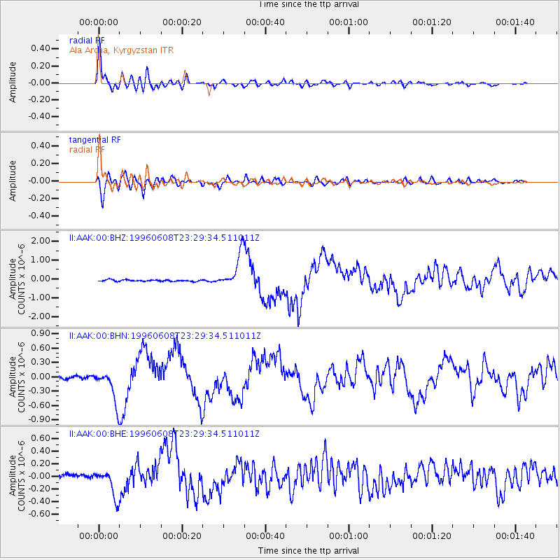
Earthquake location: Andreanof Islands, Aleutian Is.
Earthquake latitude/longitude: 51.5/-178.1
Earthquake time(UTC): 1996/06/08 (160) 23:19:15 GMT
Earthquake Depth: 33 km
Earthquake Magnitude: 5.9 MB, 6.3 MS, 6.5 UNKNOWN, 6.1 MS
Earthquake Catalog/Contributor: WHDF/NEIC
Network: II Global Seismograph Network (GSN - IRIS/IDA)
Station: AAK Ala Archa, Kyrgyzstan
Lat/Lon: 42.64 N/74.49 E
Elevation: 1645 m
Distance: 67.1 deg
Az: 310.145 deg
Baz: 40.365 deg
Ray Param: 0.057118595
Estimated Moho Depth: 52.25 km
Estimated Crust Vp/Vs: 1.66
Assumed Crust Vp: 6.306 km/s
Estimated Crust Vs: 3.799 km/s
Estimated Crust Poisson's Ratio: 0.22
Radial Match: 95.5307 %
Radial Bump: 400
Transverse Match: 93.71961 %
Transverse Bump: 400
SOD ConfigId: 6273
Insert Time: 2010-03-01 15:36:23.040 +0000
GWidth: 2.5
Max Bumps: 400
Tol: 0.001

Signal To Noise

ChannelStoNSTALTA
II:AAK:00:BHN:19960608T23:29:34.511011Z12.0634153.5624677E-72.953117E-8
II:AAK:00:BHE:19960608T23:29:34.511011Z8.4503332.3414053E-72.7707847E-8
II:AAK:00:BHZ:19960608T23:29:34.511011Z24.9967049.853433E-73.941893E-8
Arrivals
Ps5.7 SECOND
PpPs21 SECOND
PsPs/PpSs27 SECOND