
KURK Kurchatov, Kazakhstan - Earthquake Result Viewer
| ||||||||||||||||||
| ||||||||||||||||||
| ||||||||||||||||||
|
Signal To Noise
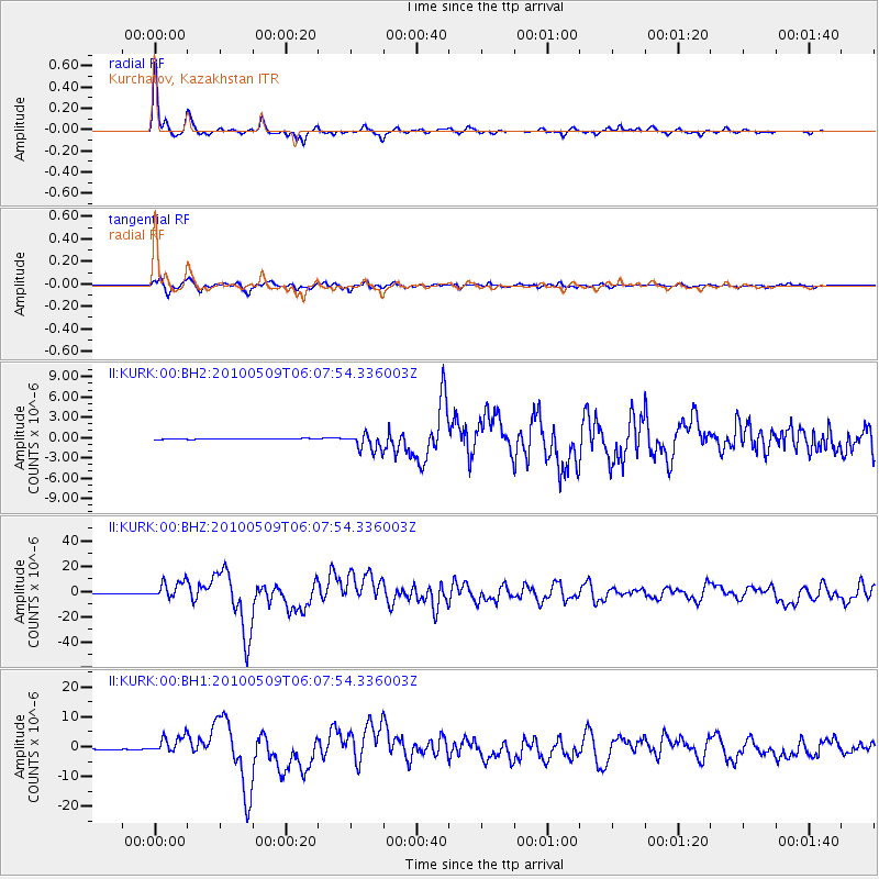
| Channel | StoN | STA | LTA |
| II:KURK:00:BHZ:20100509T06:07:54.336003Z | 32.592766 | 6.9152893E-6 | 2.1217251E-7 |
| II:KURK:00:BH1:20100509T06:07:54.336003Z | 19.66572 | 2.9591426E-6 | 1.5047212E-7 |
| II:KURK:00:BH2:20100509T06:07:54.336003Z | 21.593973 | 1.2317943E-6 | 5.7043426E-8 |
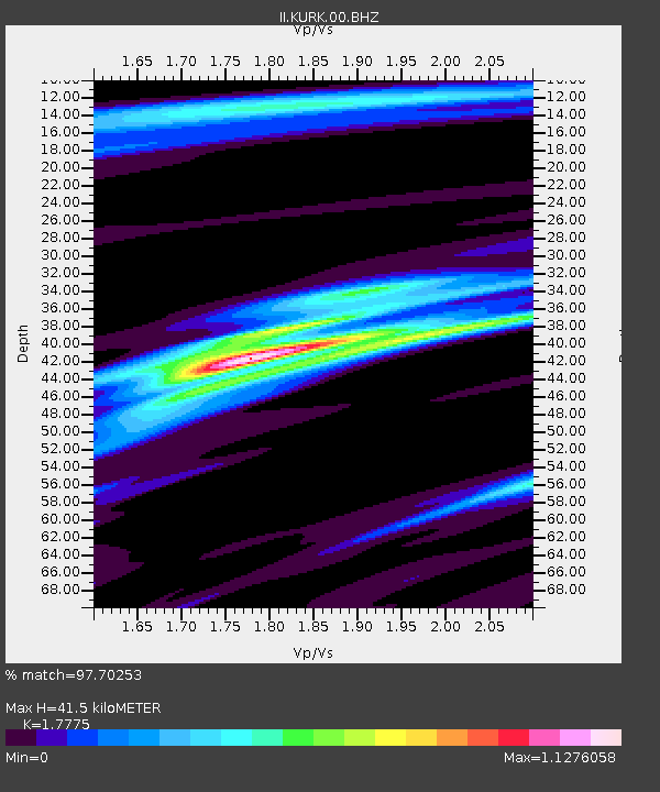
| Arrivals | |
| Ps | 5.2 SECOND |
| PpPs | 17 SECOND |
| PsPs/PpSs | 22 SECOND |

