MSEY Mahe, Seychelles - Earthquake Result Viewer
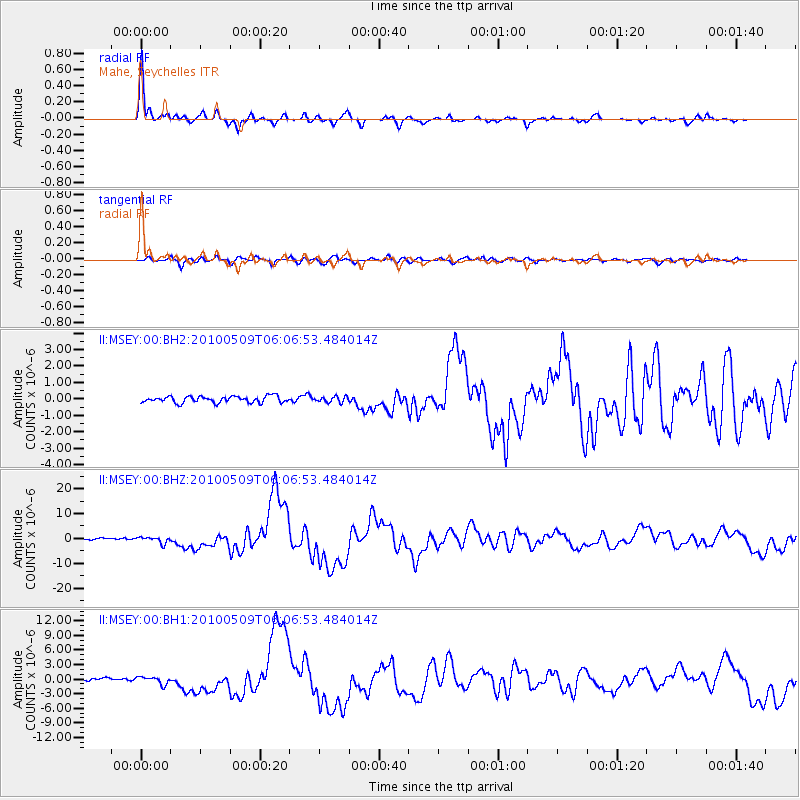
Earthquake location: Northern Sumatra, Indonesia
Earthquake latitude/longitude: 3.7/96.0
Earthquake time(UTC): 2010/05/09 (129) 05:59:41 GMT
Earthquake Depth: 38 km
Earthquake Magnitude: 7.2 MW, 6.6 MB, 7.2 MW, 7.3 MS
Earthquake Catalog/Contributor: NEIC PDE/NEIC PDE-M
Network: II Global Seismograph Network (GSN - IRIS/IDA)
Station: MSEY Mahe, Seychelles
Lat/Lon: 4.67 S/55.48 E
Elevation: 475 m
Distance: 41.4 deg
Az: 258.657 deg
Baz: 78.998 deg
Ray Param: 0.07375718
Estimated Moho Depth: 32.75 km
Estimated Crust Vp/Vs: 1.65
Assumed Crust Vp: 6.303 km/s
Estimated Crust Vs: 3.826 km/s
Estimated Crust Poisson's Ratio: 0.21
Radial Match: 92.150215 %
Radial Bump: 306
Transverse Match: 78.66239 %
Transverse Bump: 400
SOD ConfigId: 617450
Insert Time: 2013-10-01 05:00:20.930 +0000
GWidth: 2.5
Max Bumps: 400
Tol: 0.001

Signal To Noise

ChannelStoNSTALTA
II:MSEY:00:BHZ:20100509T06:06:53.484014Z4.59946871.2309159E-62.6762135E-7
II:MSEY:00:BH1:20100509T06:06:53.484014Z3.16238937.832936E-72.4769045E-7
II:MSEY:00:BH2:20100509T06:06:53.484014Z0.900952641.7570127E-71.9501721E-7
Arrivals
Ps3.6 SECOND
PpPs13 SECOND
PsPs/PpSs16 SECOND