
KEV Kevo, Finland - Earthquake Result Viewer
| ||||||||||||||||||
| ||||||||||||||||||
| ||||||||||||||||||
|
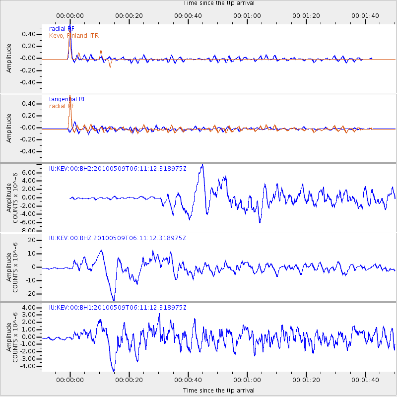
Signal To Noise
| Channel | StoN | STA | LTA |
| IU:KEV:00:BHZ:20100509T06:11:12.318975Z | 12.596092 | 3.4613765E-6 | 2.7479766E-7 |
| IU:KEV:00:BH1:20100509T06:11:12.318975Z | 3.6642728 | 5.208817E-7 | 1.4215146E-7 |
| IU:KEV:00:BH2:20100509T06:11:12.318975Z | 8.182854 | 1.3278162E-6 | 1.6226812E-7 |
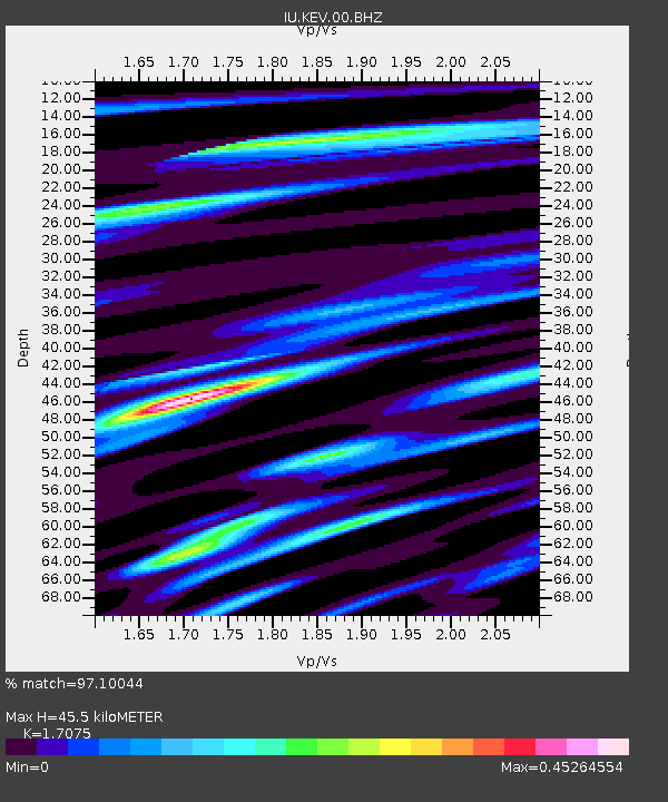
| Arrivals | |
| Ps | 5.0 SECOND |
| PpPs | 18 SECOND |
| PsPs/PpSs | 23 SECOND |

