You are here: Home > Network List > IU - Global Seismograph Network (GSN - IRIS/USGS) Stations List
> Station HNR Honiara, Solomon Islands > Earthquake Result Viewer
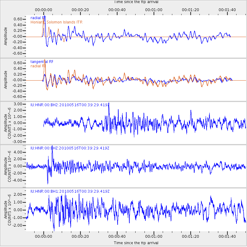
HNR Honiara, Solomon Islands - Earthquake Result Viewer
*The percent match for this event was below the threshold and hence no stack was calculated.
| Earthquake location: |
Minahassa Peninsula, Sulawesi |
| Earthquake latitude/longitude: |
0.5/124.7 |
| Earthquake time(UTC): |
2010/05/16 (136) 00:33:06 GMT |
| Earthquake Depth: |
123 km |
| Earthquake Magnitude: |
5.7 MB, 5.8 MW, 5.8 MW |
| Earthquake Catalog/Contributor: |
WHDF/NEIC |
|
| Network: |
IU Global Seismograph Network (GSN - IRIS/USGS) |
| Station: |
HNR Honiara, Solomon Islands |
| Lat/Lon: |
9.44 S/159.95 E |
| Elevation: |
100 m |
|
| Distance: |
36.5 deg |
| Az: |
106.612 deg |
| Baz: |
283.783 deg |
| Ray Param: |
$rayparam |
*The percent match for this event was below the threshold and hence was not used in the summary stack. |
|
| Radial Match: |
61.43929 % |
| Radial Bump: |
400 |
| Transverse Match: |
67.69986 % |
| Transverse Bump: |
400 |
| SOD ConfigId: |
617450 |
| Insert Time: |
2013-10-01 05:05:50.202 +0000 |
| GWidth: |
2.5 |
| Max Bumps: |
400 |
| Tol: |
0.001 |
|
Signal To Noise
| Channel | StoN | STA | LTA |
| IU:HNR:00:BHZ:20100516T00:39:29.419Z | 6.7506757 | 1.919227E-6 | 2.843015E-7 |
| IU:HNR:00:BH1:20100516T00:39:29.419Z | 1.6073792 | 6.3114913E-7 | 3.9265728E-7 |
| IU:HNR:00:BH2:20100516T00:39:29.419Z | 1.6120601 | 6.4003956E-7 | 3.970321E-7 |
| Arrivals |
| Ps | |
| PpPs | |
| PsPs/PpSs | |


