You are here: Home > Network List > TA - USArray Transportable Network (new EarthScope stations) Stations List
> Station V56A Mocksville, NC, USA > Earthquake Result Viewer
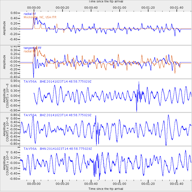
V56A Mocksville, NC, USA - Earthquake Result Viewer
*The percent match for this event was below the threshold and hence no stack was calculated.
| Earthquake location: |
Southern Bolivia |
| Earthquake latitude/longitude: |
-21.4/-66.7 |
| Earthquake time(UTC): |
2014/10/23 (296) 14:39:57 GMT |
| Earthquake Depth: |
223 km |
| Earthquake Magnitude: |
3.9 ML |
| Earthquake Catalog/Contributor: |
ISC/ISC |
|
| Network: |
TA USArray Transportable Network (new EarthScope stations) |
| Station: |
V56A Mocksville, NC, USA |
| Lat/Lon: |
35.81 N/80.50 W |
| Elevation: |
237 m |
|
| Distance: |
58.4 deg |
| Az: |
346.888 deg |
| Baz: |
164.929 deg |
| Ray Param: |
$rayparam |
*The percent match for this event was below the threshold and hence was not used in the summary stack. |
|
| Radial Match: |
57.89237 % |
| Radial Bump: |
400 |
| Transverse Match: |
61.07192 % |
| Transverse Bump: |
400 |
| SOD ConfigId: |
3390531 |
| Insert Time: |
2019-04-14 16:55:53.945 +0000 |
| GWidth: |
2.5 |
| Max Bumps: |
400 |
| Tol: |
0.001 |
|
Signal To Noise
| Channel | StoN | STA | LTA |
| TA:V56A: :BHZ:20141023T14:48:58.775029Z | 1.7127484 | 4.4362613E-7 | 2.5901417E-7 |
| TA:V56A: :BHN:20141023T14:48:58.775029Z | 0.7795546 | 1.5309388E-7 | 1.9638635E-7 |
| TA:V56A: :BHE:20141023T14:48:58.775029Z | 0.8574755 | 2.5484061E-7 | 2.971987E-7 |
| Arrivals |
| Ps | |
| PpPs | |
| PsPs/PpSs | |


