You are here: Home > Network List > US - United States National Seismic Network Stations List
> Station KSU1 Kansas State University--Konza Prairie, Kansas, USA > Earthquake Result Viewer
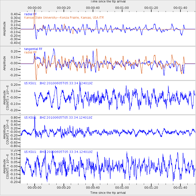
KSU1 Kansas State University--Konza Prairie, Kansas, USA - Earthquake Result Viewer
*The percent match for this event was below the threshold and hence no stack was calculated.
| Earthquake location: |
Kuril Islands |
| Earthquake latitude/longitude: |
43.4/146.8 |
| Earthquake time(UTC): |
2010/06/05 (156) 05:22:02 GMT |
| Earthquake Depth: |
58 km |
| Earthquake Magnitude: |
5.5 MW, 5.5 MB, 5.5 MW |
| Earthquake Catalog/Contributor: |
NEIC PDE/NEIC PDE-M |
|
| Network: |
US United States National Seismic Network |
| Station: |
KSU1 Kansas State University--Konza Prairie, Kansas, USA |
| Lat/Lon: |
39.10 N/96.61 W |
| Elevation: |
347 m |
|
| Distance: |
79.8 deg |
| Az: |
44.967 deg |
| Baz: |
318.57 deg |
| Ray Param: |
$rayparam |
*The percent match for this event was below the threshold and hence was not used in the summary stack. |
|
| Radial Match: |
44.62222 % |
| Radial Bump: |
400 |
| Transverse Match: |
56.788933 % |
| Transverse Bump: |
400 |
| SOD ConfigId: |
617450 |
| Insert Time: |
2013-10-01 06:04:51.187 +0000 |
| GWidth: |
2.5 |
| Max Bumps: |
400 |
| Tol: |
0.001 |
|
Signal To Noise
| Channel | StoN | STA | LTA |
| US:KSU1: :BHZ:20100605T05:33:34.124019Z | 3.4483821 | 2.4630435E-7 | 7.1426065E-8 |
| US:KSU1: :BH1:20100605T05:33:34.124019Z | 1.0916231 | 7.6364614E-8 | 6.9955114E-8 |
| US:KSU1: :BH2:20100605T05:33:34.124019Z | 1.0848986 | 8.53729E-8 | 7.869206E-8 |
| Arrivals |
| Ps | |
| PpPs | |
| PsPs/PpSs | |


