KURK Kurchatov, Kazakhstan - Earthquake Result Viewer
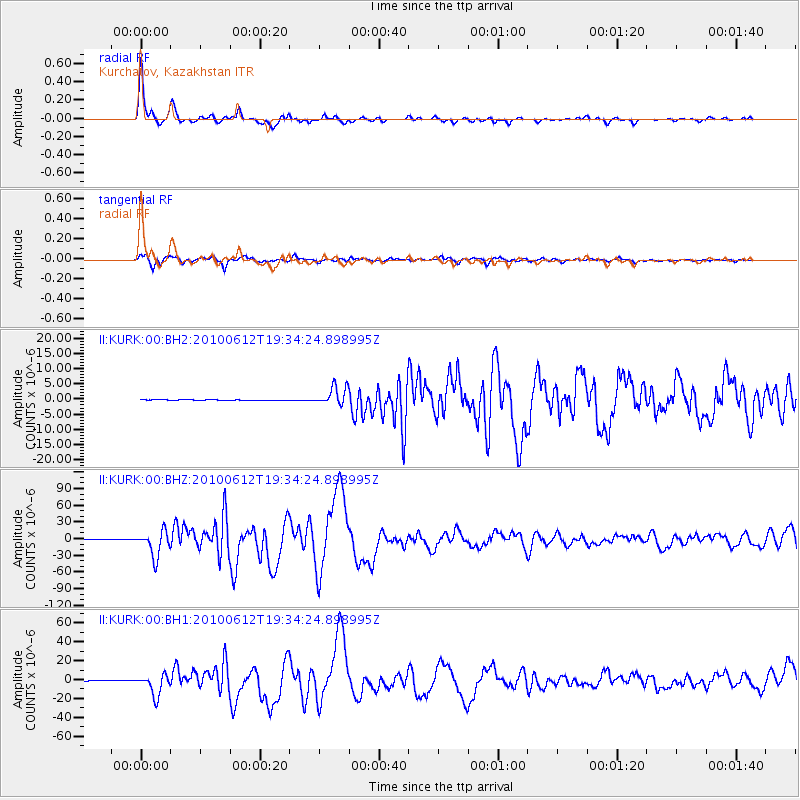
Earthquake location: Nicobar Islands, India Region
Earthquake latitude/longitude: 7.9/91.9
Earthquake time(UTC): 2010/06/12 (163) 19:26:50 GMT
Earthquake Depth: 35 km
Earthquake Magnitude: 7.5 MW, 7.0 MB, 7.4 MW, 7.5 MS
Earthquake Catalog/Contributor: NEIC PDE/NEIC PDE-M
Network: II Global Seismograph Network (GSN - IRIS/IDA)
Station: KURK Kurchatov, Kazakhstan
Lat/Lon: 50.72 N/78.62 E
Elevation: 184 m
Distance: 44.1 deg
Az: 347.857 deg
Baz: 160.864 deg
Ray Param: 0.07204862
Estimated Moho Depth: 41.5 km
Estimated Crust Vp/Vs: 1.81
Assumed Crust Vp: 6.552 km/s
Estimated Crust Vs: 3.62 km/s
Estimated Crust Poisson's Ratio: 0.28
Radial Match: 97.56645 %
Radial Bump: 245
Transverse Match: 95.542755 %
Transverse Bump: 400
SOD ConfigId: 617450
Insert Time: 2013-10-01 06:19:20.176 +0000
GWidth: 2.5
Max Bumps: 400
Tol: 0.001

Signal To Noise

ChannelStoNSTALTA
II:KURK:00:BHZ:20100612T19:34:24.898995Z80.9397052.279776E-52.816635E-7
II:KURK:00:BH1:20100612T19:34:24.898995Z60.9816061.0941141E-51.7941707E-7
II:KURK:00:BH2:20100612T19:34:24.898995Z48.7881283.0262836E-66.20291E-8
Arrivals
Ps5.5 SECOND
PpPs17 SECOND
PsPs/PpSs22 SECOND