MSEY Mahe, Seychelles - Earthquake Result Viewer
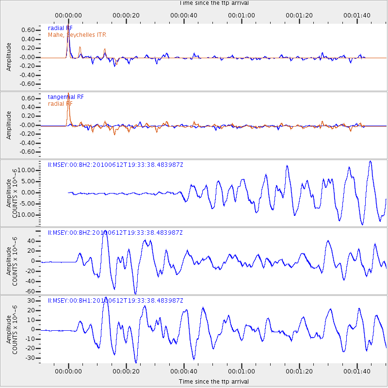
Earthquake location: Nicobar Islands, India Region
Earthquake latitude/longitude: 7.9/91.9
Earthquake time(UTC): 2010/06/12 (163) 19:26:50 GMT
Earthquake Depth: 35 km
Earthquake Magnitude: 7.5 MW, 7.0 MB, 7.4 MW, 7.5 MS
Earthquake Catalog/Contributor: NEIC PDE/NEIC PDE-M
Network: II Global Seismograph Network (GSN - IRIS/IDA)
Station: MSEY Mahe, Seychelles
Lat/Lon: 4.67 S/55.48 E
Elevation: 475 m
Distance: 38.4 deg
Az: 252.268 deg
Baz: 71.212 deg
Ray Param: 0.07548614
Estimated Moho Depth: 30.25 km
Estimated Crust Vp/Vs: 1.84
Assumed Crust Vp: 6.303 km/s
Estimated Crust Vs: 3.425 km/s
Estimated Crust Poisson's Ratio: 0.29
Radial Match: 88.95245 %
Radial Bump: 259
Transverse Match: 89.18541 %
Transverse Bump: 355
SOD ConfigId: 617450
Insert Time: 2013-10-01 06:19:24.148 +0000
GWidth: 2.5
Max Bumps: 400
Tol: 0.001

Signal To Noise

ChannelStoNSTALTA
II:MSEY:00:BHZ:20100612T19:33:38.483987Z14.9024716.9890734E-64.6898757E-7
II:MSEY:00:BH1:20100612T19:33:38.483987Z21.1199974.2093934E-61.9930843E-7
II:MSEY:00:BH2:20100612T19:33:38.483987Z1.73215754.1837777E-72.4153564E-7
Arrivals
Ps4.3 SECOND
PpPs13 SECOND
PsPs/PpSs17 SECOND